
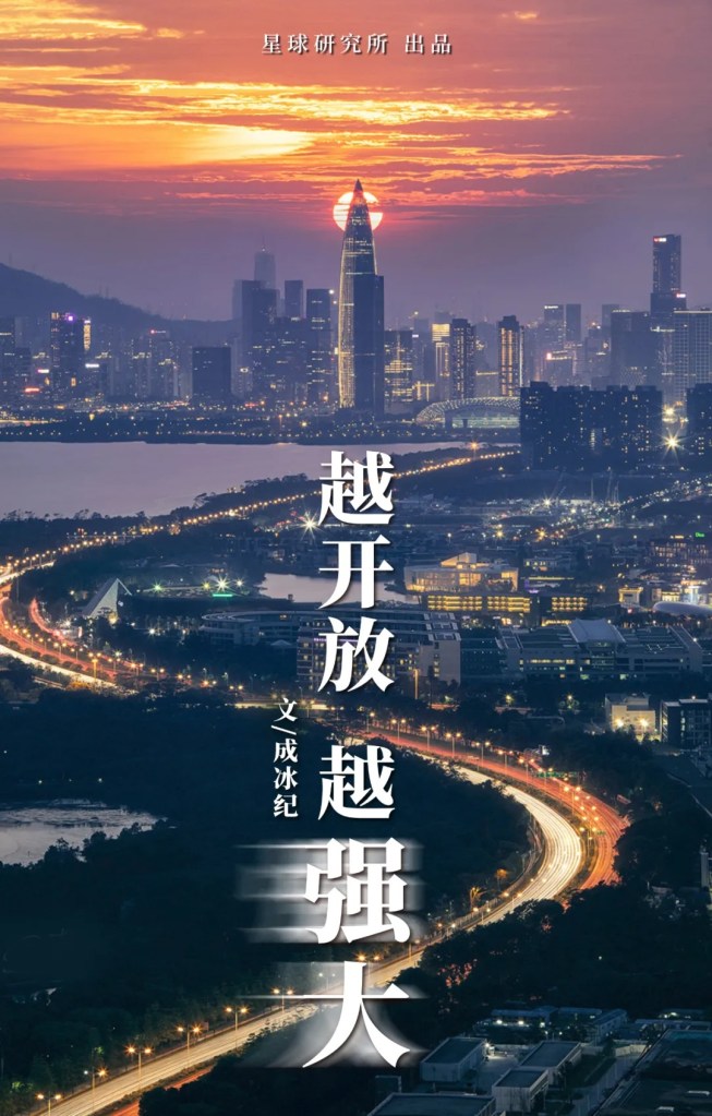
Original piece: 《粤港澳:造一个大大大大大大湾区!》
Produced by Institute for Planets (星球研究所)
Sponsored by 万科南方区域
Written by 成冰纪
Translated by Kelvin Kwok
Posted with permission from Institute for Planets
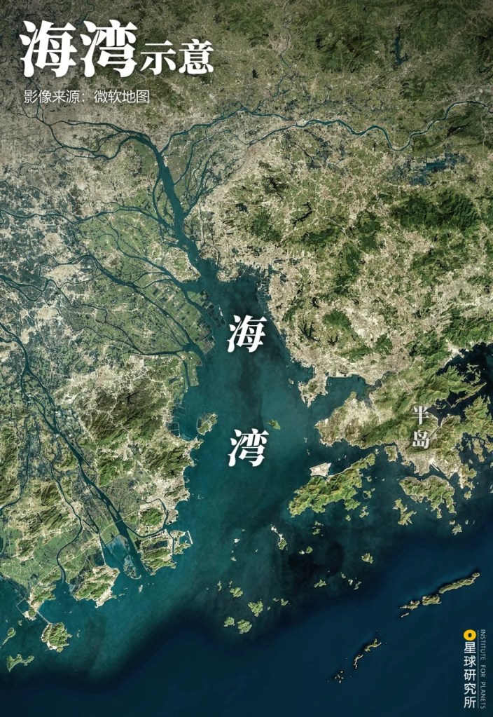
A bay is by definition a body of water connected to the ocean on one side and surrounded by land on the remaining three sides.
(diagram: 巩向杰&巧克莉, Institute for Planets)
And the term bay area is used to describe the cluster of neighbouring bays as well as the connected land and islands.
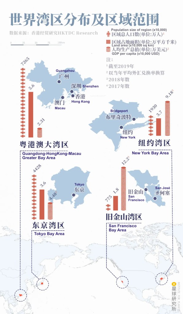
The New York Bay Area, San Francisco Bay Area, Tokyo Bay Area and the Guangdong-HongKong-Macau Greater Bay Area in China are together known as the Four Great Bay Areas. They are at the pinnacle of prosperity and technological innovation on this planet.
(diagram: 王申雯&巩向杰, Institute for Planets)
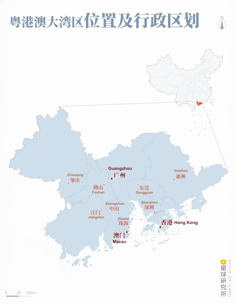
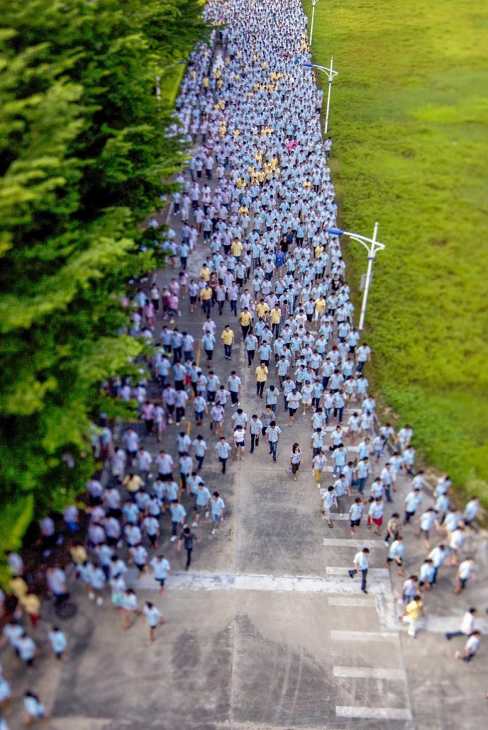
The Guangdong-HongKong-Macau Greater Bay Area (hereafter Greater Bay Area) consists of nine cities and two special administrative regions. Spanning 0.6% of China’s territory, this megalopolis is home to 5% of the entire Chinese population and contributes 12% of the country’s GDP.
(diagram: 巩向杰&王申雯, Institute for Planets)
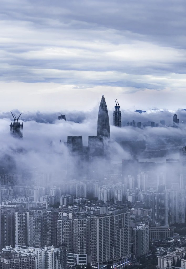
Compared to other bay areas in the world, there is ample room for growth in the Greater Bay Area — a rising star on the world stage of bay area contest.
(photo: 索以)
How can the Greater Bay Area make itself stand out?
From our point of view, over the past two thousand years, it is openness that has driven the sequential rise of cities including Guangzhou, Hong Kong and Shenzhen; it is openness that has shaped the economic strength and cultural heritage of the Greater Bay Area.
As the saying goes, with more openness comes greater power.
1. Formation of the bay
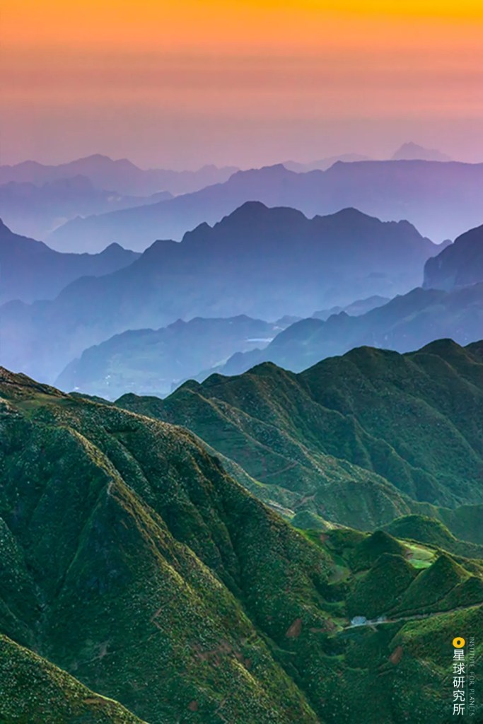
There is a colossal water basin lying between Eurasia, the largest continent on Earth, and the Pacific, the world’s largest and deepest ocean: the Pearl River Basin.
(photo: 视觉中国)
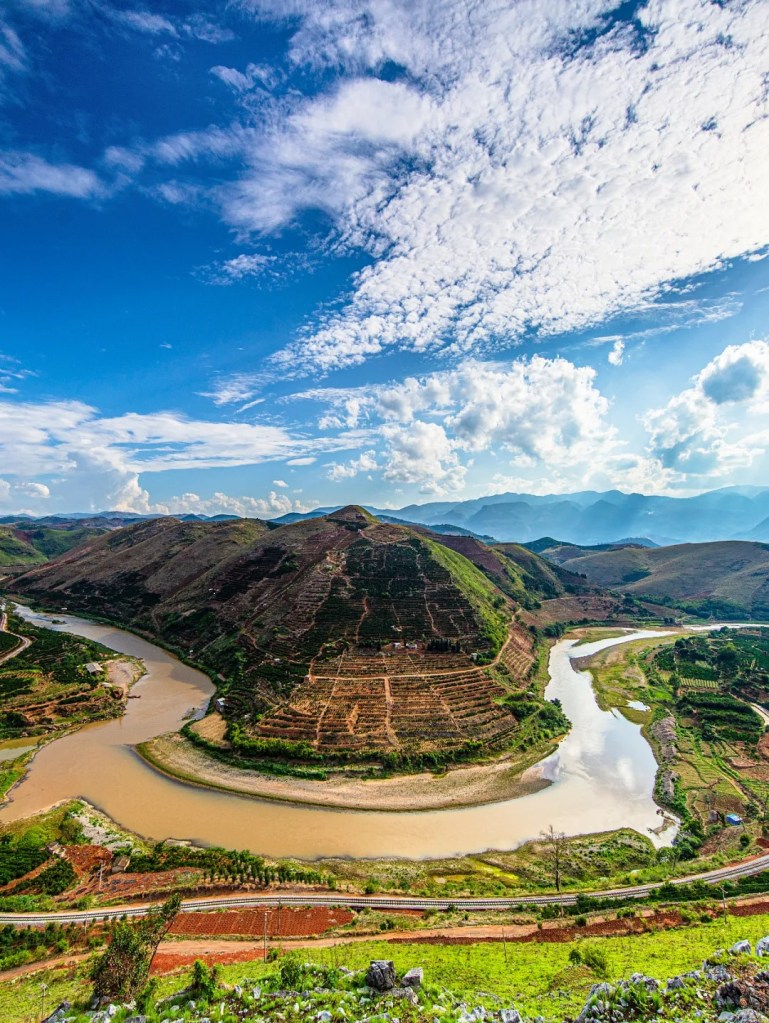
The Pearl River originates from the dense mountain ranges sitting in southern China, where its three major tributaries, Xi River, Bei River and Dong River, rush down the heights towards low-lying regions.
Among the three, Xi River makes the grandest voyage starting from the Wumeng Mountains thousands of miles away in Yunnan.
Xi River originates from Maxiong Mountain of the mountain ranges
(photo: 柴峻峰)
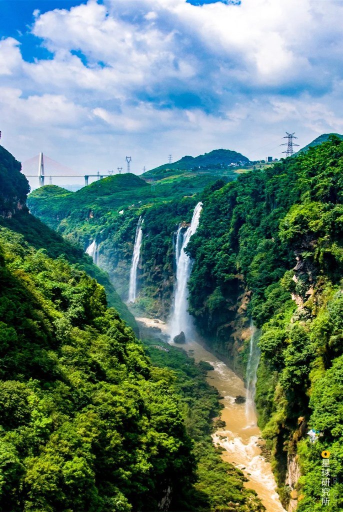
Guided by the terrain, Xi River flows southeastward through the Shiwan Mountain, Jiuwan Mountain, Liuwan Mountain and Yunkai Mountain, carving out the Sanrong Gorge, Dading Gorge and Lingyang Gorge (Zhaoqing Gorge) along the way.
(photo: 笑飞雪)
It finally enters the sea near today’s Zhuhai. Stretching 2214 kilometres, it is the fourth longest river in China after Yangtze River, Yellow River and Amur River (Heilong River).
Adding to each of the major tributaries are their own tributaries, including Beipan River, Liu River, Yu River, Zeng River, Lian River, Bin River, Sui River and Xizhi River. These waters combine to form the Pearl River Basin that spreads out across the land like a giant web.
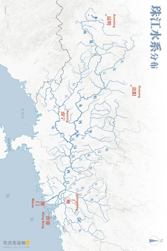
(diagram: 王申雯&巩向杰, 星球研究所)
Its average runoff volume per year can reach up to 330 billion cubic metres, which is seven times that of Yellow River. That the Pearl River Basin is still one of the most abundant water resources in China today really makes one wonder — what could this wild river have looked like far back in time when its scale was not confined by any human activities?

(photo: 视觉中国)
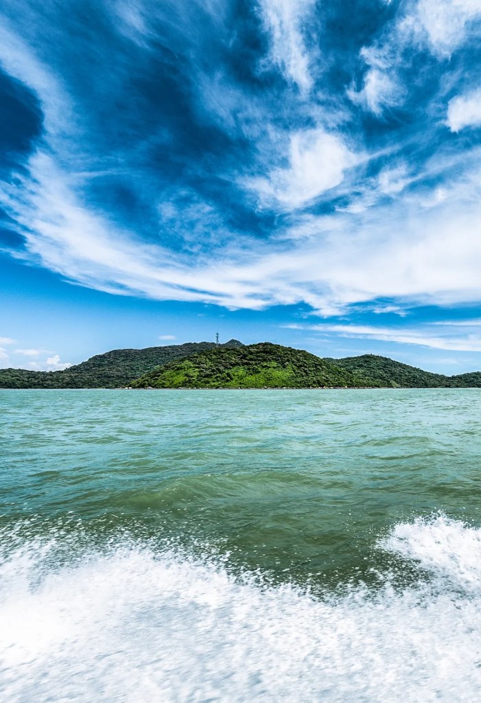
But even this proud Pearl River is humbled by the vast South China Sea.
The estuary of the river is known as the Pearl River Delta. Due to its tropical location, it is regularly brushed by monsoons and frequently raged by typhoons. Lingdingyang, one of the estuarine channels of Pearl River, is never a calm place.
(photo: 吴亦丹)
This is exactly where the two giants, river and ocean, engage in the endless tug of war in geography terms.
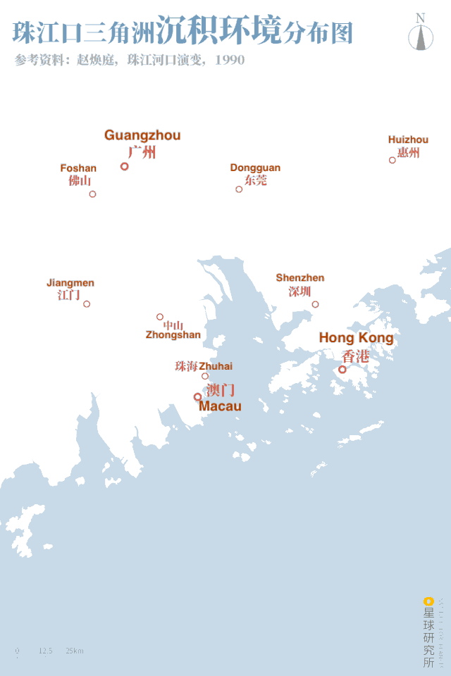
About 7,500 years ago, the sea level raised to its highest point for the past 10,000 years, submerging the archaic estuary of Pearl River and reshaped the river delta. On the other hand, emerging human activities transformed the river basin and exacerbated sedimentation, turning the Pearl River Delta into what we see today.
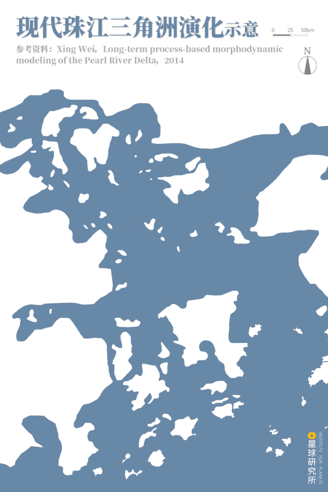
(diagram: 王申雯&巩向杰, 星球研究所)
Morphed by a grand river and the ocean, this bay was all set for its journey to success.
2. The Guangzhou Era
The rich and fertile land of Guangzhou was once a paradise for any creature that roamed on it. Asian elephants, Sumatran rhinoceros, Javan rhinoceros and Malayan gharial were wandering through the forests, while hawksbill sea turtle, shelled mollusks, marine mammals and fish and shrimps were swimming in the South China Sea. There were treasures including gold, silver, copper, iron and jade hidden deep in the mountain ranges waiting to be found.

It was the official seal for Nanyue King; now kept in the Museum of the Nanyue King of Western Han Dynasty
(photo: 柳叶氘)
In 221 BC, the rare products and vast land mass here lured the Qin empire into dispatching 500 thousand soldiers on multiple military and reclamation expeditions.
“Attracted by rhino horns, ivories, jade and pearl in the State of Yue, (Qin Shu Huang) ordered General Tu Sui to lead 5 divisions of 500,000 soldiers … to fight the Yue people.”
“(秦始皇)利越之犀角、象齿、翡翠、珠玑乃使尉屠睢发卒五十万,为五军……以与越人战 ”
Huainanzi: In the World of Men 《淮南子·人间训》
The Qin dynasty established the Nanhai Commandery and built the city of Panyu in the heartland of Lingnan region. It monitors western Guangdong and Guangxi on the west and controls eastern Guangdong on the east. This is the city that would later become Guangzhou.
The key to the rise of Guangzhou lies in its unique geographical location. It touches the Pearl River and has a vast bay. As early as in Qin and Han dynasties, people were already able to sails and travel on waters using the power of monsoons. But since shipbuilding and navigation technologies were still very primitive then, countless ships were sent to the bottom of South China Sea by typhoons and roaring waves.
(photo: 视觉中国)
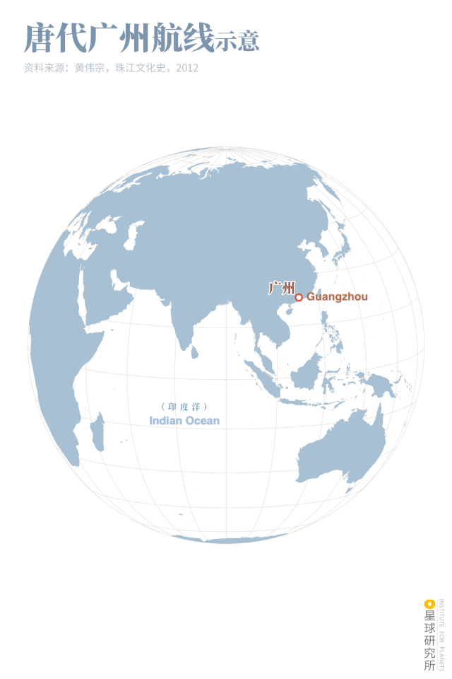
Yet with constantly improving technologies, people could later build five-deck battleships that were more than a hundred feet tall in Sui dynasty, and eventually enormous merchant ships that can carry hundreds of passengers or even keep livestock pigs on board in Sung dynasty. As the people slowly learned how to tame the raging waves, they travelled farther and farther, gradually weaving the elaborate ocean trade network that reaches the Indo-Chinese Peninsula, India, Mesopotamia, Persian Gulf and the Red Sea.
(diagram: 巩向杰&王申雯, Institute for Planets)
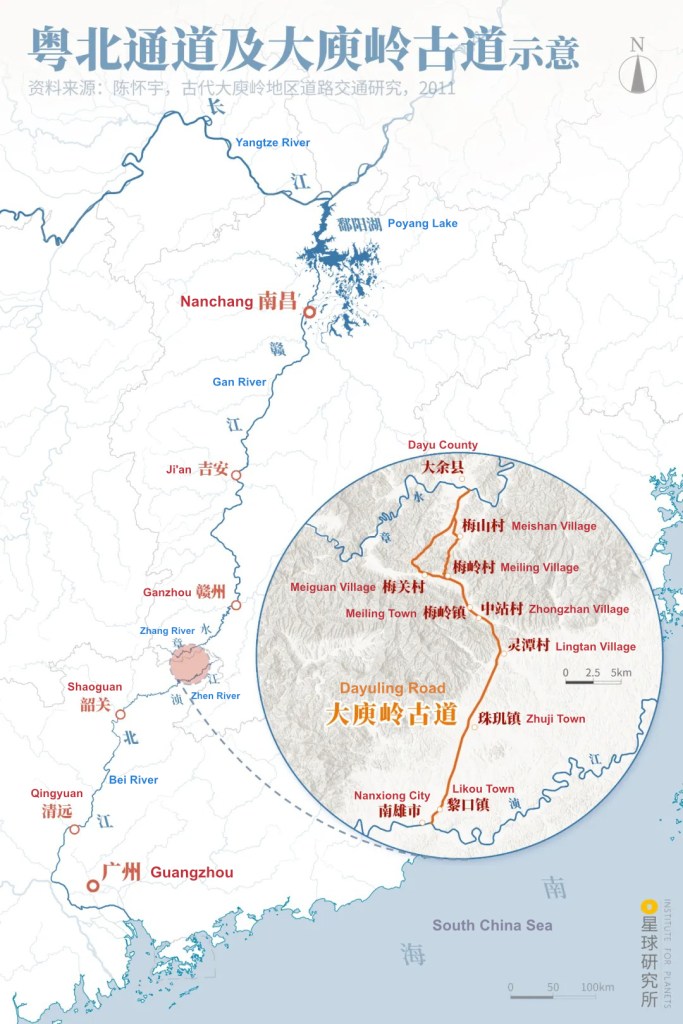
Besides, Guangzhou sits right at the centre of Pearl River Delta where tens of thousands of drainage basins converge. Linked through the Bei River-Nanling-Gan River-Poyang Lake-Yangtze River corridor, the basin of Pearl River Delta had already become part of the national canal intermodal transport system back in Sui and Tang dynasties, clearly demonstrating the rather mature inland waterway technologies then. Construction and maintenance of the Dayuling Road also greatly enhanced the transportation capacity of this Northern Guangdong channel.
(diagram: 王申雯&巩向杰, Institute for Planets)
The internal shipping line travelling north and the external trading network extending south really opened up Guangzhou and turned it into a trading metropolis. Later on, during Qianlong period of Qing dynasty when the Canton System was implemented, Guangzhou even became the only Chinese port open to the world.
With prospering trade, Guangzhou’s economy grew rapidly and so did the city area. On top of that, Guangzhou was blessed with a temperate climate, beautiful landscape as well as abundant and diverse products, that the locals could not be more passionate about urban life so rich in exquisite necessities. This was what seasoned the vivid flavours of life in Guangzhou since then.

(photo: 二中兄)
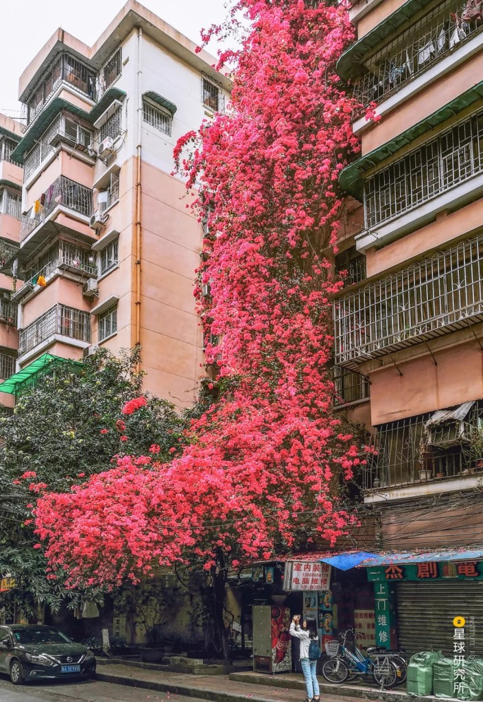
Flower fairs have been extremely popular in and around Guangzhou since ancient times, and this heritage is still very much alive today in this ‘flower city’.
(photo: 何易成)
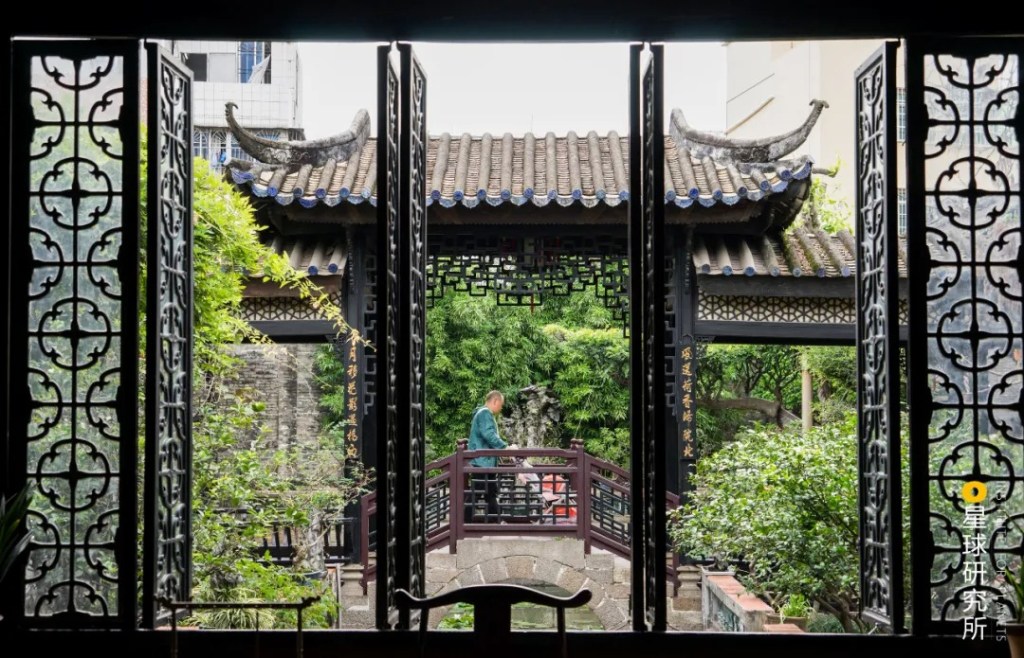
The open and inclusive character of Guangzhou allows it to blend together many different cultures. Walking through the city, one will see traditional Chinese gardens…
(photo: 二中兄)
… and Nanyang-style arcades.

(photo: 张贤炜)
There are buddhist temples…

(photo: 颜光辉)
… as well as mosques.
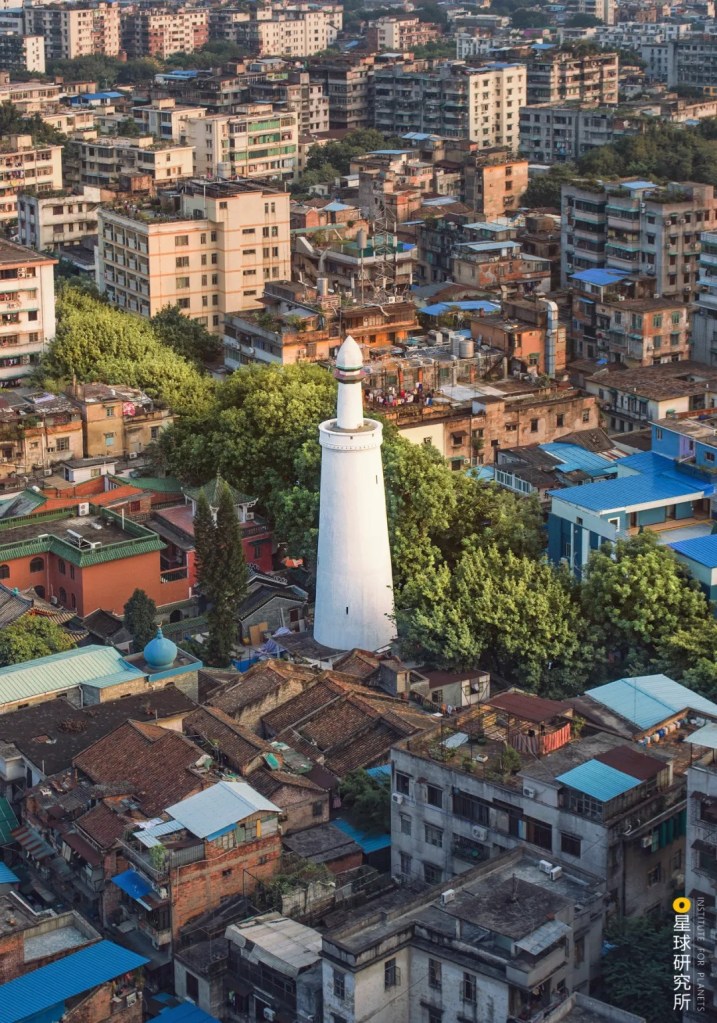
(photo: 何易成)
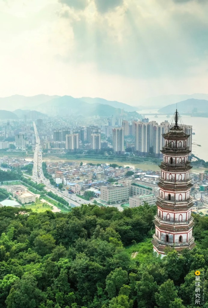
From the Panyu city in Qin dynasty to Guangzhou metropolis during Ming and Qing, openness has continued to drive the rise of Guangzhou over the past 2000 years. No wonder this city can now stand out in the Greater Bay Area.
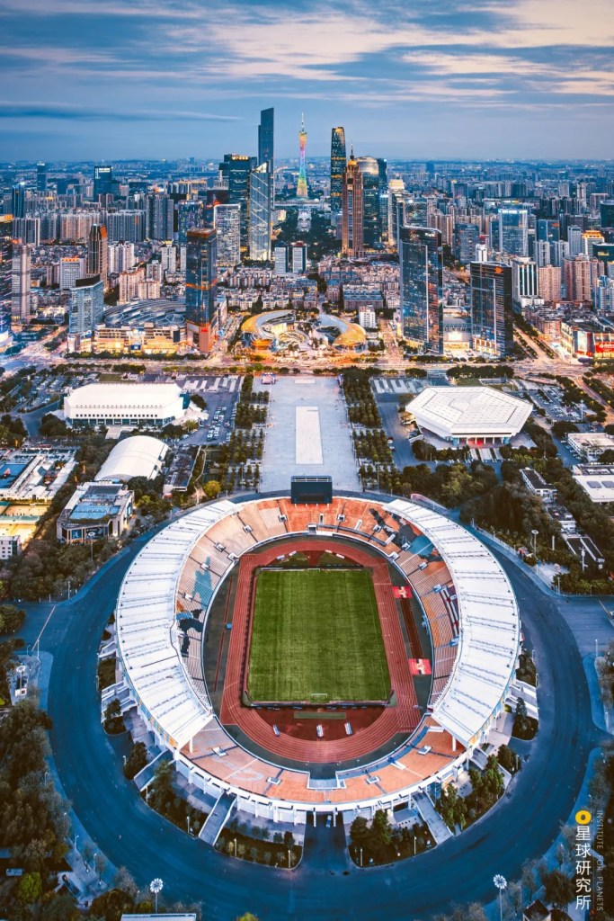
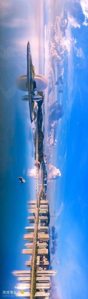
Landmarks from near to far: Tianhe Stadium, Haixinsha Island, Canton Tower
(photo: 静言)
But many things can happen over 2000 years. The stream of Pearl River flowing into the South China Sea has never stopped shaping the Greater Bay Area. The change might be too slow to be observable, but is absolutely drastic given enough time.
3. The Hong Kong Era
The ancient estuary of Pearl River once chewed into the land by as much as 150 kilometres, almost reaching today’s Zhaoqing. At that time, aquatic plants were abundant along the Pearl River Basin and the sand content in the river was relatively low, hence the delta was only growing very slowly.
“The Lingnan region used to be covered by sea in ancient times.”
“昔者五岭以南皆大海尔”
Shunde County Annals by Feng Fengchu (冯奉初《顺德县志》)
But since the Ming and Qing dynasties, there had been increasing activities of farming and development which gradually blocked the estuary, so the coast kept retreating southwards. Now that the situation was changing, regions further out at the sea took up the baton as the contact point for communication with the world.
Macau is located at the outmost point on the west bank of the Pearl River estuary, almost like a finger of the delta pointing at the Lingdingyang. Since all merchant ships arriving from the western oceans have to go past Macau before entering Guangzhou, Macau was once the exterior port for Guangzhou.
The Portuguese who came from the Atlantic Ocean had already started occupying since 1553 during Jiajing period of Ming dynasty.
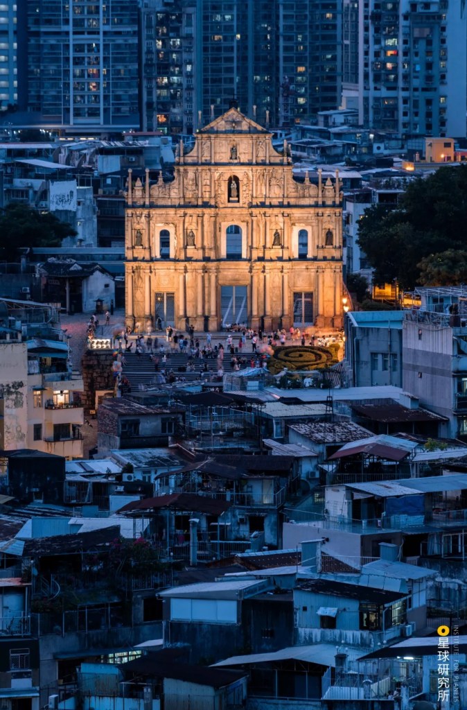
These ruins of a Catholic church built by the Portuguese are a witness of Macau’s colonial history
(photo: 黄昆震)
Yet the empire ruling over Macau did not seem to be aware of the enormous change that was about to come. Indeed, it was already a totally different world by the time the First Opium War broke out in 1840, which led to the rise of another young city, Hong Kong.
Hong Kong has a hilly terrain, where the bedrock of mountains and islands extends deep into the sea. With little flat land available for development, it used to be populated only by farmers, fishermen and rock miners.
(photo: 视觉中国)
But for the colonisers, this ‘disadvantage’ is instead an advantage. Bedrocks sitting deep in the South China Sea allow the formation of numerous bays with deep waters. Moreover, since Hong Kong is located on the east bank of Pearl River and far away from the main estuary, it experiences less sand and soil sedimentation caused by waves, tides and ocean currents. These create the necessary conditions for the birth of a super port.
(diagram: 王申雯&巩向杰, Institute for Planets)
When the British initiated the grand scheme of development in Hong Kong, they first established the city as a free port, at which both Chinese and foreign merchant ships are exempt from customs duty. Second, they introduced the British political, military and legal systems to build an ordered business environment and crackdown on pirates. Third, they improved the infrastructure in Hong Kong, including the Queen’s Road, the first road to be built on Hong Kong Island, as well as the Nathan Road, which traverses the centre of Kowloon. By the end of 19th century, the total road mileage had exceeded 152 kilometres.

(photo: 静言)
Prior to British occupation, the heart of Hong Kong Island was situated in Stanley in the south, because the central regions were too steep and cramped that few people lived there. On the contrary, the northern part of the island and Kowloon across the harbour are surrounded by mountains and islands which provide shelter from typhoons. Hence they were the best places to build a city.
The first street lamps were lid in 1841, followed by provision of fresh water supply in 1846. In the same year, there were more than 1800 buildings standing in the city. This commercial city rapidly rising from the bare ground was named City of Victoria.

(photo: Vanny)
Wanchai, Causeway Bay, Quarry Bay and Shau Kei Wan on Hong Kong Island, as well as Tsim Sha Tsui, Yaumatei, Mongkok and Kowloon City in Kowloon all became Hong Kong’s business district.
(photo: 张登科)
The open policies, safe environment and comprehensive infrastructure attracted a lot of investments from Chinese and foreign businesses.

(photo: 视觉中国)
As the economy grew, Hong Kong became an international entrepot trade centre, and one of the population confluence centres for the Greater Bay Area and even the whole country.
During the 1850s, the South China region was in constant turmoil. The Taiping Heavenly Kingdom Movement led to enormous influx of fleeing refugees into Hong Kong and consequently the continuous population boom.
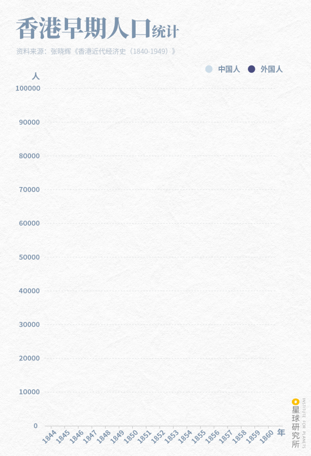
Light colour bars: Chinese; dark colour bars: foreigners
(diagram: 王申雯, Institute for Planets)
The fierce collision between oriental traditions and Western culture in Hong Kong created a culture unique to the city.
(photo: 陈金涛)
It was in such an environment that the Western science and technologies as well as new thoughts were able to enter the ancient China through Hong Kong, which prepared the Greater Bay Area for its alignment with international conventions.
This was destined to be the age of change,
when the new replaced the old, and the ocean conquered the land.
Oars were substituted by sails, which were in turn replaced by steam engines;
an agricultural empire was dealt a blow by a maritime empire;
and the reign of an age-old empire was succeeded by a new empire.
Flowing with the torrents of time, the Greater Bay Area will now turn a new page. But unlike the “forced opening” Hong Kong has previously experienced, this will be an active choice made for the pursuit of national rejuvenation.
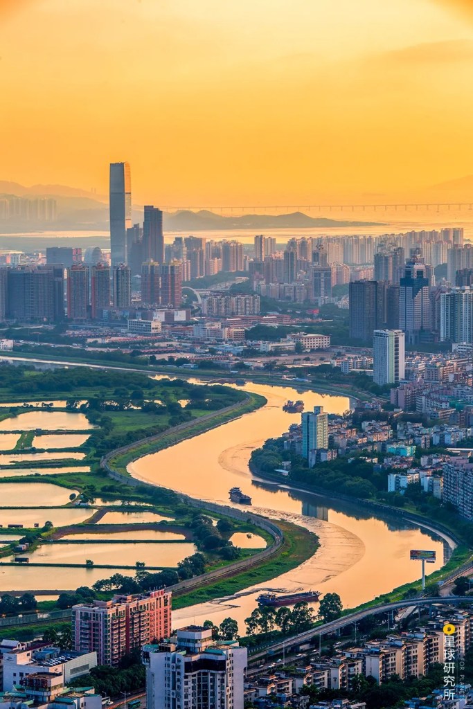
4. The Shenzhen Era
When the new China was founded, the world was shrouded in the shadow of Cold War tensions. The Shenzhen River between the New Territories of Hong Kong and Bao’an County of Guangdong became the frontline of the confrontation between the two camps. Western countries imposed economic blockade that once shut off all communication between Guangdong and Hong Kong.
(photo: 打呼上山)
But the theme of the contemporary world was no longer wars and confrontation, but peace, openness, union and development. This led to the rise of another new city, Shenzhen. It neighbours Hong Kong and is backed by the Mainland in the north. Connected to the ocean through Dapeng Bay and Daya Bay on the east and Shenzhen Bay and Pearl River estuary on the west, it holds the key position in the city cluster of Greater Bay Area.
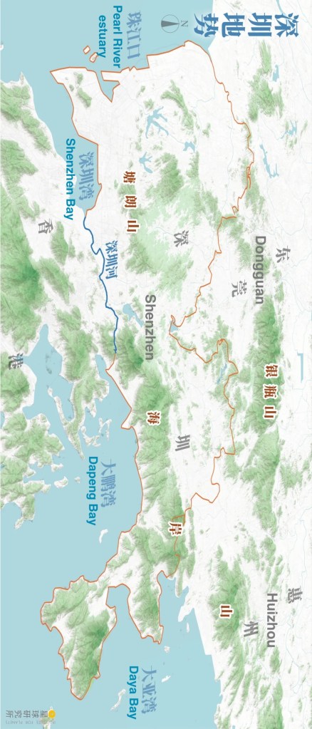
(diagram: 王申雯&巩向杰, Institute for Planets)
With the advantage of being close to Hong Kong, Shenzhen was established as a special economic zone in 1980. However, this city, previously the Bao’an County, was but a blank canvas then, spanning only 3.5 square kilometres of land area with a population of 23,000 by 1979. It had a weak industrial foundation, and backward transportation, education and healthcare system.
To make the change, Shenzhen first needed to open its doors to the world and make use of its unique advantage. This includes exporting fresh agricultural products to Hong Kong and engaging in processing and assembly industries to attract foreign investment and technologies. While developing these industries, Shenzhen was simultaneously transformed into a base for foreign trade export.

Founded in Shenzhen, Huawei is now valued at more than a trillion yuan
(photo: 视觉中国)
To the west of Shenzhen, Nantou Peninsula is located across the sea from Hong Kong and Macau. It has multiple deep water harbours most suitable for developing industries and constructing ports. The Shekou Industrial Zone established in 1979 was the first Chinese industrial zone open to the world.
(photo: 潘锐之)
On top of industrial development, Shenzhen conducted urban development swiftly. Between 1980 and 1994, new town areas such as Luohu, Shangbu, Shekou and Overseas Chinese Town rose up from the ground one after another, where the city area expanded at 12 square kilometres on average every year. This was the Shenzhen speed that made “building one storey every three days” possible.
(photo: 超哥)
Within a few years, Shenzhen completed the construction of roads, bridges, drainage, electricity and communication infrastructure.

(photo: 蒙治光)
Shenzhen University, stadium, science and technology institutions, libraries, TV stations, museums, opera theatres, news agencies and airport. Everything was completed one by one.
In order to attract Hong Kong tourists, Shenzhen put great effort in maintaining tourist environment and the service industry. Shatoujiao, Yantian and Dameisha and Xiaomeisha beaches are scenic districts with mountain and sea views adorned by a vast coastline. They provide an excellent foundation for the development of tourism.

(photo: 龚强)
Shatoujiao town, in particular, was only 0.12 square kilometres in area with merely 800 residents. When the New Territories was forcibly leased to the British, the town was cut in half, together with a small street called Chung Ying Street (lit. China-Britain Street). Taking advantage of its role as the border with New Territories, Shatoujiao opened up to residents on both sides and became a duty free commercial street implementing “one street two systems”. There could be as many as 10,000 visitors shopping here every day.

(photo: 关灵)
What openness brought to Shenzhen was not only foreign investment and technologies, but also the courage to be the world’s pioneer and a far-sighted international vision.
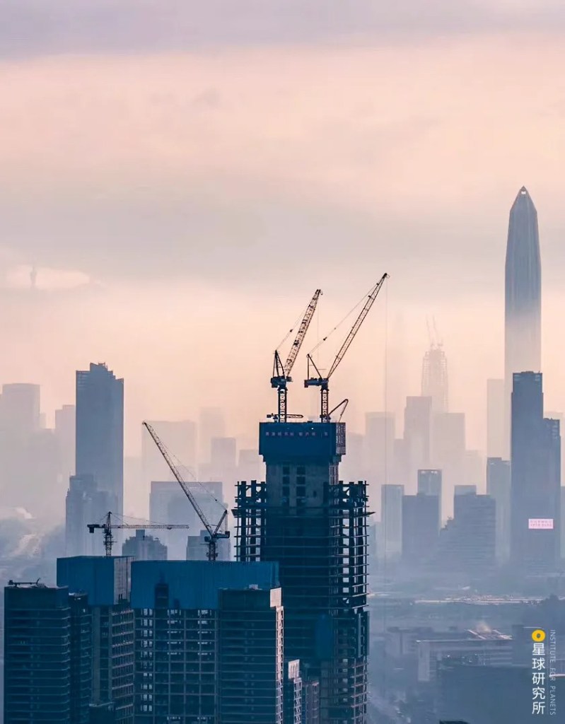
Although the economic foundation of Shenzhen was laid through being an original equipment manufacturer for industries worldwide, this was clearly not sustainable. Therefore, technological innovation was regarded as the core of the city’s development ever since it was built. In the 1990s, Shenzhen again seized the opportunity to transform when electronic and information technology industries in the US, Europe, Japan and Korea underwent industrial transfer. This laid the cornerstone of its high-tech industries.
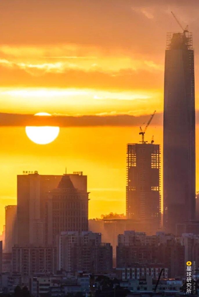
(photo: 视觉中国)
Hong Kong has high capability in scientific research, whereas Shenzhen is able to turn research outcomes into marketable products. As the two joined forces, numerous high-tech enterprises specialising in communications, chips and biotechnologies were founded in Shenzhen. This was how Shenzhen achieved the brilliant transformation from the “world’s factory” into the “city of innovation”.
This ability to innovate has penetrated through every sector, including industries like finance, banking and insurance…
The tallest building in the photo is the Ping An Finance Centre
(photo: 谭皓)
…and the emerging trend of internet…
(photo: 龚强)
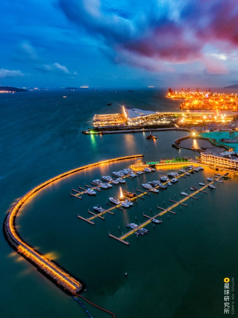
…or even tourism. All these are displaying the city’s determination to continue embracing the world after having risen through its open policies.

(photo: 龚强)
5. The Greater Bay Area Era
With the deepening of the reform and opening-up policy, the 9+2 city agglomeration constituted of Guangzhou, Shenzhen, Zhuhai, Foshan, Huizhou, Dongguan, Zhongshan, Jiangmen, Zhaoqing, Hong Kong and Macau has finally taken form.
Guangzhou, being the centre of the Greater Bay Area, undergoes comprehensive development. Its neighbour, Foshan, whose economy size is ranked third after Guangzhou and Shenzhen, has many industrial parks and specialty towns and hence is an important manufacturing base.
(photo: 蒙治光)
In the northwest, Zhaoqing is not only rich in touristy resources, but is also competent in emerging industries such as biomedicine, electronic and information technology and automotive part manufacturing.
(photo: 李琼)
Hong Kong, the century-old free port, is still the Greater Bay Area’s international doorway and the super-connector between China and the world. Right next to it, Shenzhen is the national innovation base which attracts more and more young talents and entrepreneurs. Dongguan and Huizhou, owing to their geographical location beside Guangzhou and Hong Kong, have become the heart of manufacturing.
(photo: 欧迪鹏)
Macau acts as the cooperation platform between China and Portuguese-speaking countries in addition to its role as a tourist centre.
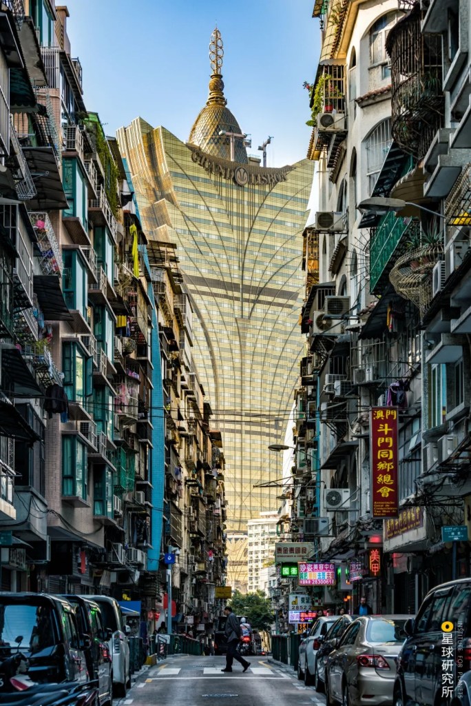
(photo: 黄昆震)
Zhuhai, another special economic zone, is involved in joint development with Macau while making remarkable progress in precision machinery manufacturing and other related industries.
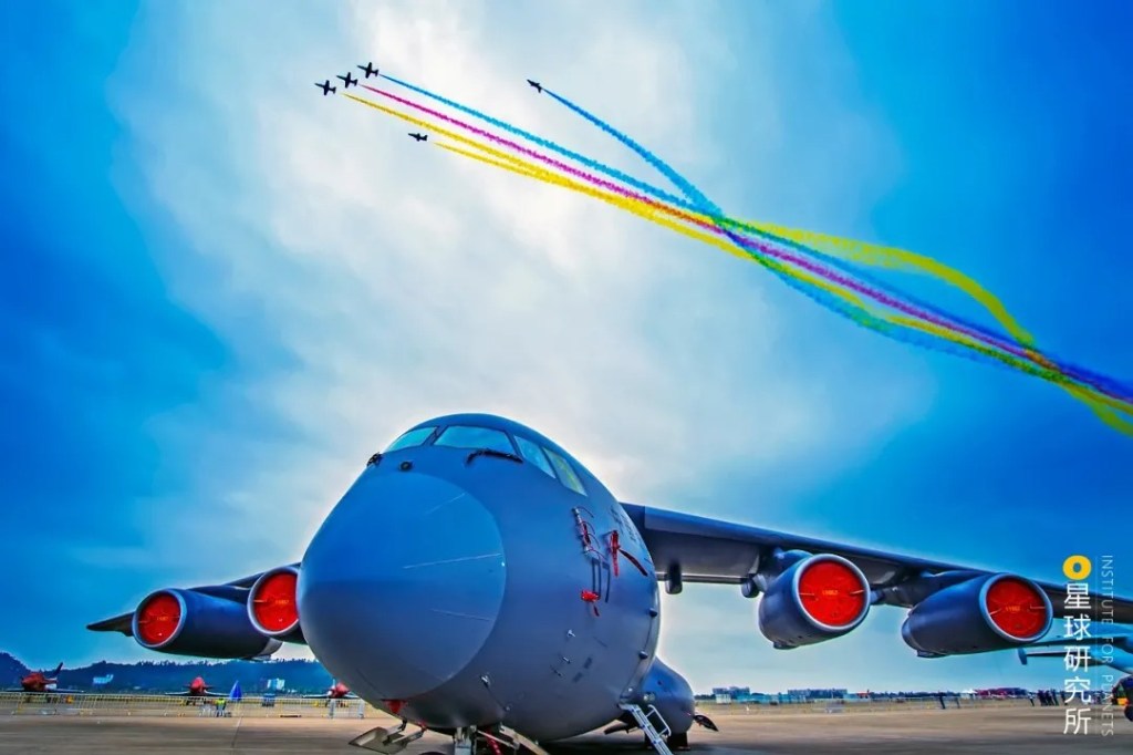
The Red Falcon Aerobatic Team from the PLA Air Force Aviation University is performing in the air
(photo: 潘劲草)
Zhongshan and Jiangmen, both neighbour of Macau, are empowered by traditional industrial strength.
The Greater Bay Area today is much more than the geographical concept of a bay. It is an “economic bay” and an “open bay” that welcomes the world. It has a tremendously vast land mass supported by the entire pan Pearl River Delta region, which brings about a steady influx of population.
(photo: 视觉中国)
These eleven cities piece together a comprehensive ecosystem comprised of industry, service industry and high-tech industry that is brimming with productivity and creativity. Moreover, with 40 years, 200 years and even 2000 years of cultural heritage, the Greater Bay Area is one of the most marketised and internationalised regions in China.
Shenzhen Bao’an International Airport is among the World’s Top 100 Airports
(photo: 谭皓)
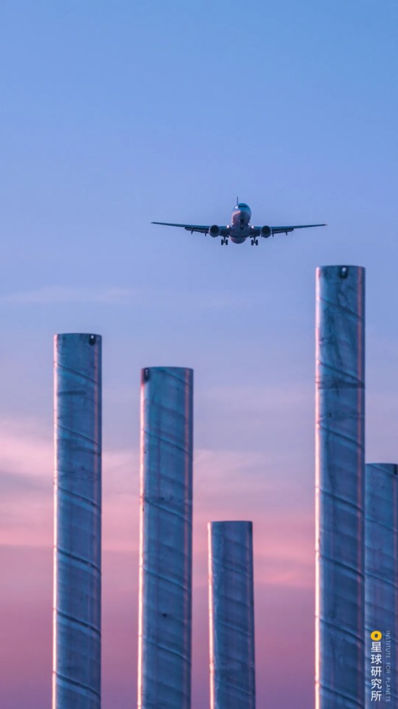
Its dense clusters of airports and ports ensure it is closely connected with the world.
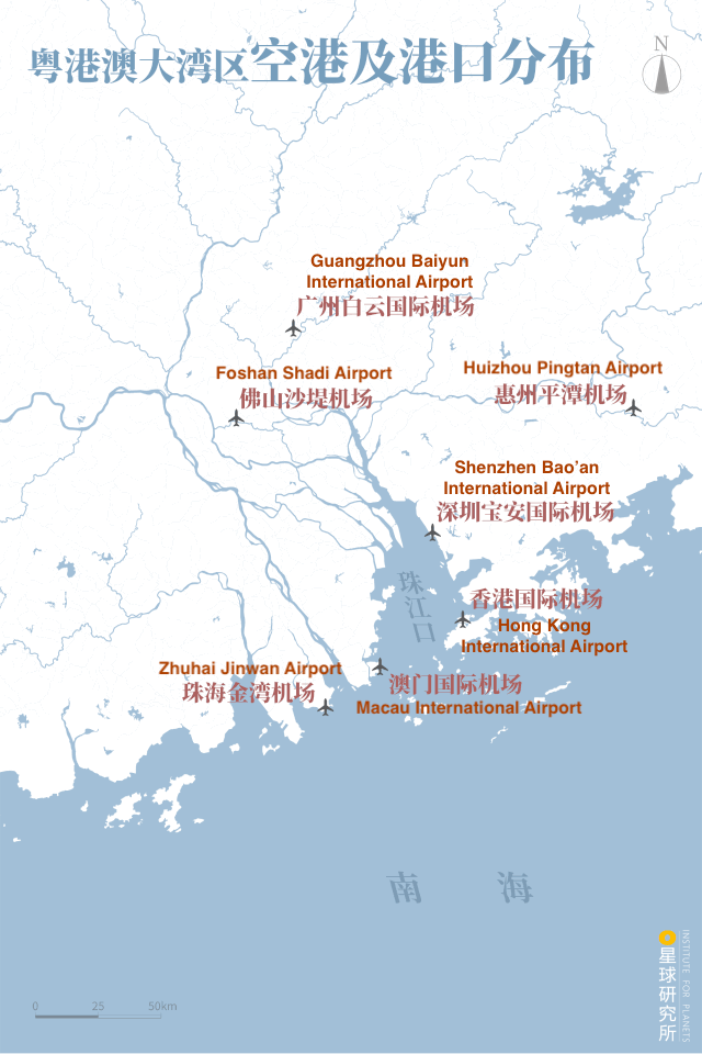
(diagram: 王申雯&巩向杰, Institute for Planets)
Under China’s grand strategy of opening up, the Greater Bay Area, which liaises between multiple neighbouring economic zones and acts as the confluence point for the Belt and Road Initiative, has irreplaceable geographical advantages and hence an indispensable role in the region.
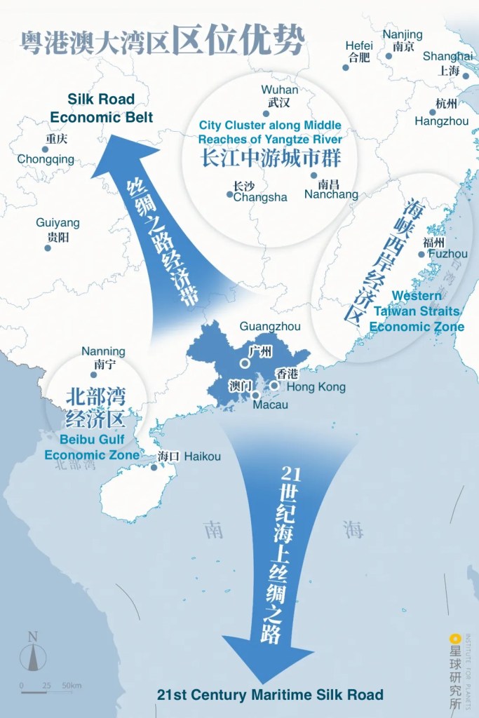
(diagram: 王申雯&巩向杰, Institute for Planets)
How can all these advantages be put to good use? The answer is simply full-scale integration.
The extent of development differs on the east and west banks of Pearl River estuary. Eastern regions developed faster owing to their proximity to Hong Kong. Just 4 decades after the introduction of reform and opening up policy, the GDP of Shenzhen and Dongguan on the east was already 3 times that of Zhuhai, Zhongshan and Jiangmen on the west. To tackle this, 4 bridges were built to span the bay and link up the east and west banks.

(diagram: 王申雯&巩向杰, Institute for Planets)
The Humen Pearl River Bridge connects the two major industrial towns, namely Nansha and Humen. It was once the only channel that crosses the Pearl River estuary.
(photo: 欧迪鹏)
But this posed a massive traffic burden on the bridge. In 2019, the Humen Second Bridge (also known as the Nansha Bridge) was commissioned. This 2-way bridge with 8 lanes can accommodate 100,000 vehicles every day and greatly alleviate the congestion issue.
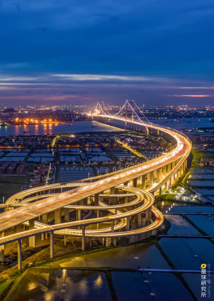
(photo: 郭昌城)
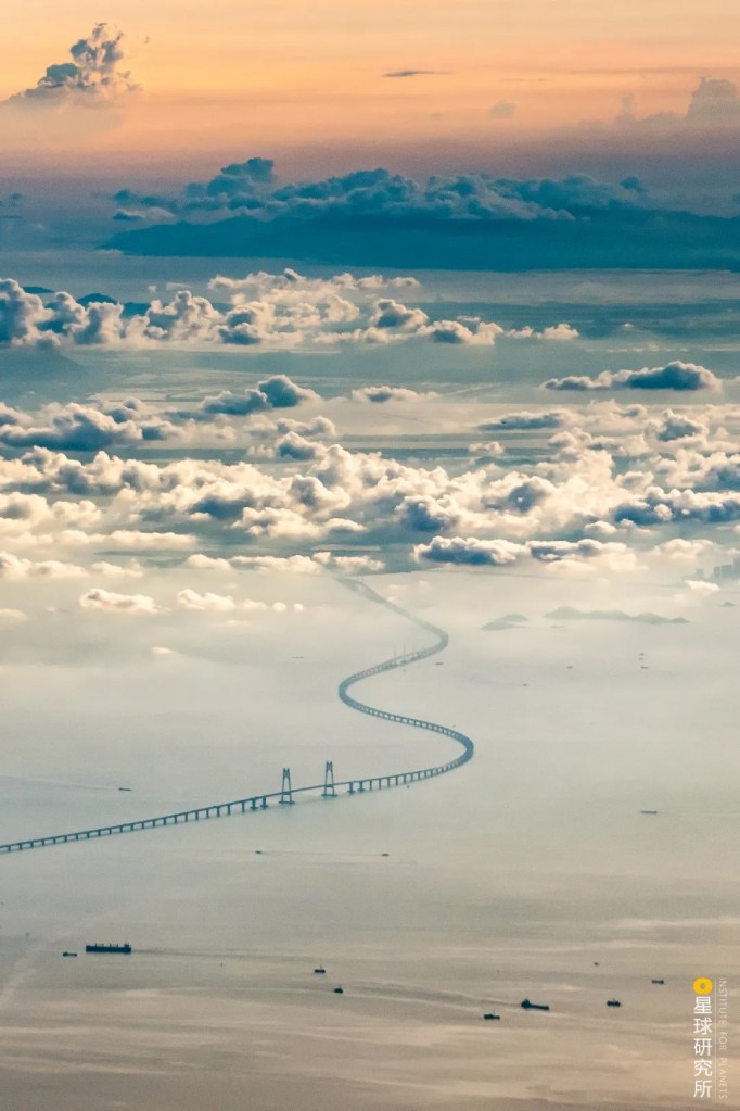
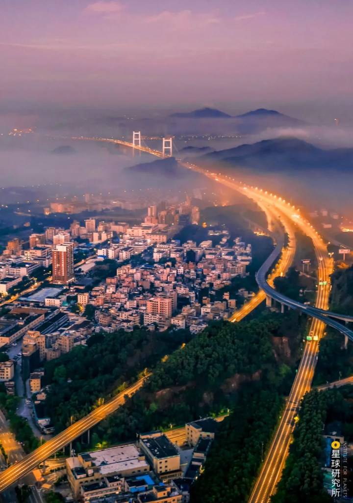
Whereas the Hong Kong-Zhuhai-Macau Bridge completed in 2018 greatly boosted the connection between Guangdong, Hong Kong and Macau. It starts from the Lantau Island in Hong Kong on the east and reaches Gongbei in Zhuhai and the Pearl in Macau on the west. The bridge is 55 kilometres long consisting of cable-stayed bridges, undersea tunnel and artificial islands, and is widely praised as the largest engineering wonder at the Pearl River estuary.

(photo: 黄昆震)
Modern transportation systems break through all natural barriers at the Pearl River delta and fused all components in the entire area into one. In recent years, the rapidly expanding high-speed railway network is forging a one-hour living circle within the Greater Bay Area.

The circle was made possible by the standard railways and high-speed railways connecting between major cities in the area
(diagram: 王申雯&巩向杰, Institute for Planets)
But the Greater Bay Area is not just about the 11 cities, it is also the home to 70 million residents. They come from all over the world, bringing in diverse languages, cultures and history, yet at the same time all blending in within the area.
While the entire area encompassing Guangdong, Hong Kong and Macau implements One Country, Two Systems and has three customs territories, it operates a streamlined border control and customs clearance. Policies concerning employment, housing, education, healthcare and social security are gradually integrated while cumbersome restrictions are progressively removed. In the future, everyone in the Greater Bay Area will enjoy a synchronised living circle.
(photo: 许玮泓)
All these bridges, whether tangible or not, have contributed much more than connectivity. Without them, there would not have been such an open, diverse and tolerant Greater Bay Area, nor a city agglomeration with such a colossal scale. Most importantly, they have created an attraction centre with a population exceeding tens of millions.
Initially, the Greater Bay Area was merely a geological product jointly created by the Pearl River and South China Sea. The climate was warm and humid, that the blue sky and clear waters became a paradise for both the blossoming greens and thriving wildlife.
Today, after striding past the Guangdong, Hong Kong, Macau and Shenzhen eras and the rise of each and every member city, the Greater Bay Area shall move on as a union and face the world with arms wide open.
Its history teaches one lesson: with more openness comes greater power.
In this turbulent world where trade protectionism is on the rise, the future of the Greater Bay Area is nonetheless crystal clear, that is to keep on opening its arms towards the world and strive for openness and tolerance.
Production Team
Text: 成冰纪
Editing: 巧克莉
Photos: 潘晨霞
Maps: 巩向杰
Design: 王申雯
Review: 撸书猫&风子&云舞空城
Cover photo: 龚强
References
[1] 赵焕庭. 珠江河口演变[M]. 海洋出版社, 1990.
[2] Chaoyu Wu. Long-term process-based morphodynamic modeling of the Pearl River Delta[J]. Ocean Dynamics, 2014.
[3] 潘安. 商都往事[M]. 中国建筑工业出版社, 2010.
[4] 阎根齐. 南海古代航海史[M]. 海洋出版社, 2016.
[5] 林广志. 澳门之魂[M]. 广东人民出版社, 2017.
[6] 张晓辉. 香港近代经济史1840-1949[M]. 广东人民出版社, 2001.
[7] 江潭瑜. 深圳改革开放史[M]. 北京人民出版社, 2010.
[8] 国世平. 粤港澳大湾区规划和全球定位[M]. 广东人民出版社, 2018.
[9] 赖梅东. 粤港澳大湾区生态资源与环境一体化建设[M]. 中国环境出版集团, 2019.
[10] 雷强 等. 粤港澳关系志[M]. 广东人民出版社, 2004.
… The End …

星球研究所
一群国家地理控,专注于探索极致风光
