
Original piece: 《什么是湖北?》
Produced by Institute for Planets (星球研究所)
Written by 星球研究所 所长
Translated by Kelvin Kwok
Posted with permission from Institute for Planets
The vicissitudes of the land of affection
An unprecedented pandemic has allowed us to revisit our impression of Hubei, and of all the components that shape the province.
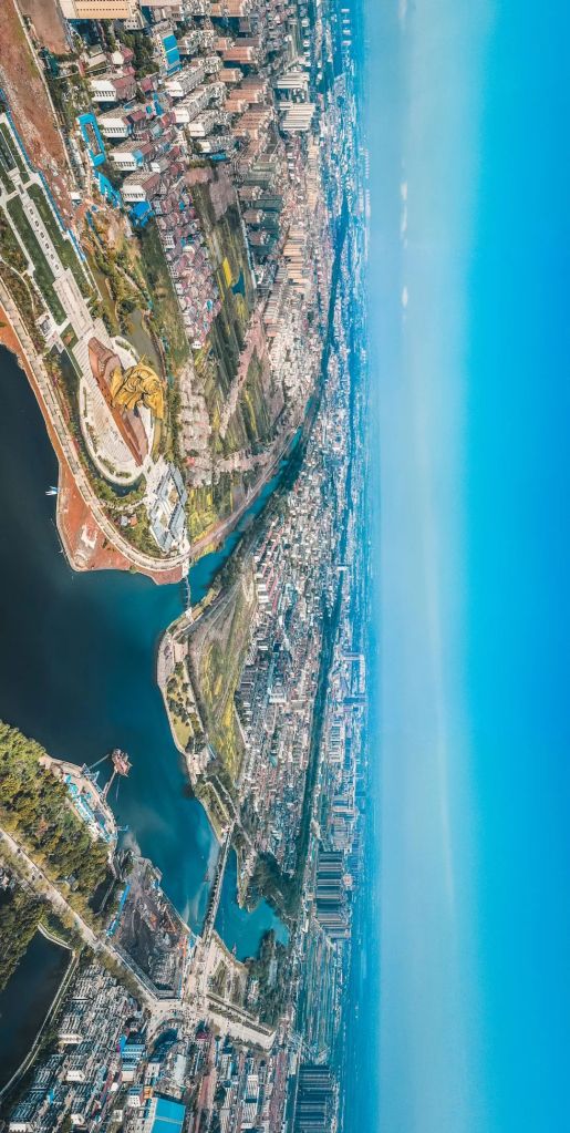
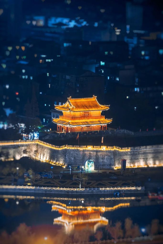
There is Xiangyang, the fortress town.
The closer water channel is an ancient moat, and the distant one is the Han River
It is a classic example of a ancient citadels that are easily guarded but difficult to attack
(photo: 颜京利)
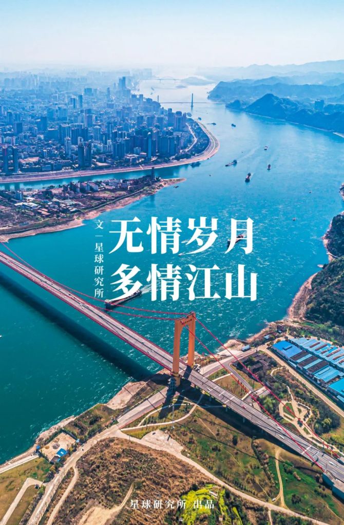
And Yichang, the city of hydraulics.
This city in which the Three Gorges Dam is located is praised as the world’s capital of hydropower
The dam on the left is the Gezhou Dam
(photo: 李理)
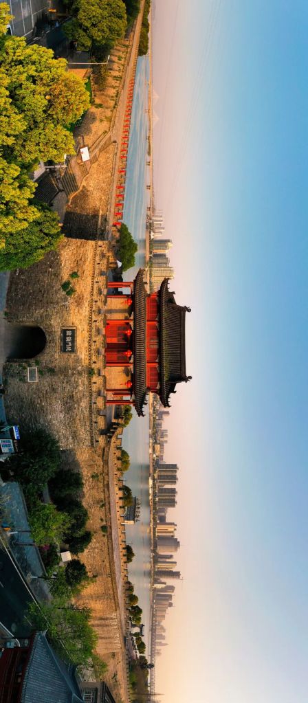
There is also Jingzhou, where…
So many momentous events, past and present, are bandied about with a laughter!
古今多少事,都付笑谈中
《临江仙》许慎 (58-148 AD)
English translation by Mr Gong Jinghao
The ancient city of Jingzhou is located in the centre of the photo surrounded by a moat
Bottom left is a statue of Guan Yu holding his 70-metre long guandao or yanyuedao (literally ‘reclining moon blade’)
(photo: 邓双)
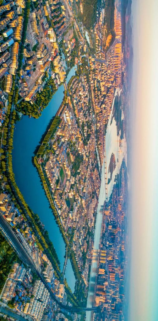
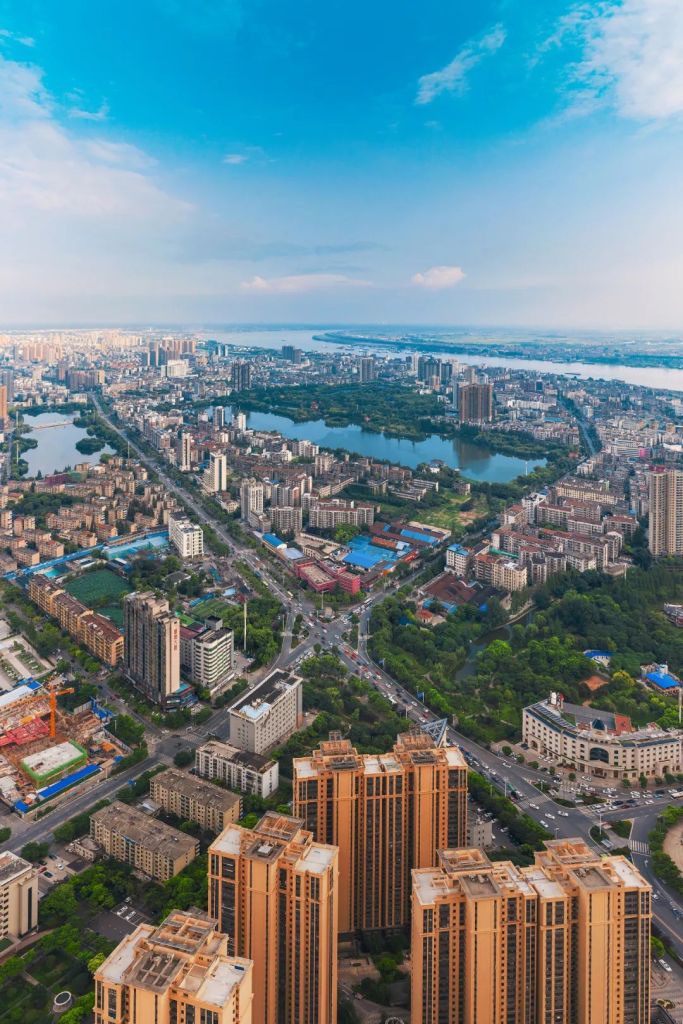
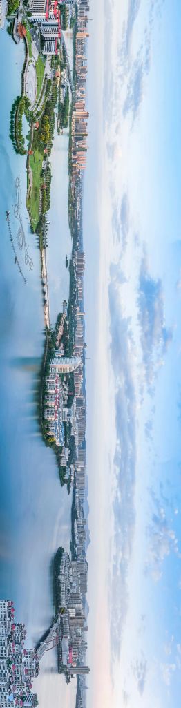
And the mighty Wuhan, where…
From the west the fresh breeze comes, sweeping away regrets of heaven and earth with mist and clouds;
to the east the river runs, scouring off sorrow of the past and present with its waves
爽气西来,云雾扫开天地憾
大江东去,波涛洗尽古今愁
《符秉忠题武汉黄鹤楼联》符秉忠
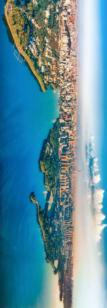
(photo: 陶进)
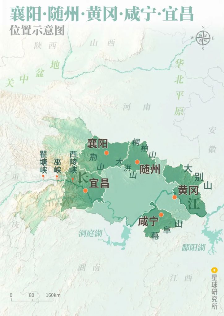
As well as Shiyan, Xiaogan, Jingmen, Ezhou, Huanggang, Xianning, Suizhou, Enshi, Huangshi, Xiantao, Qianjiang, Tianmen, and last but not least, Shennongjia, the only county-level administrative unit in the entire country that is designated ‘forestry district’.
These 17 administrative units make up the Hubei we know today.
Together, they walk through wars and floods, and fight against the pandemic.
They are so vibrant and diverse, yet many of us don’t really know them well.
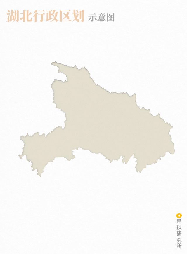
Hubei consists of 13 prefecture-level and 4 county-level administrative regions
Administrative regions: Shiyan (十堰), Xiaogan (孝感), Jingmen (荆门), Ezhou (鄂州), Huanggang (黄冈), Xianning (咸宁), Suizhou (随州), Enshi (恩施), Huangshi (黄石), Xiangtao (仙桃), Qianjiang (潜江), Tianmen (天门), Shennongjia (神农架)
(diagram: 赵榜 & 陈思琦, Institute for Planets)
So what is Hubei really?
From what we see, Hubei has survived centuries of constant hammering by devastating wars, floods and plaques. Throughout the hardship, the affectionate land has relentlessly stood in solidarity to build complementary communities with a shared destiny.
1. The heroic rise of the twin cities 双雄崛起
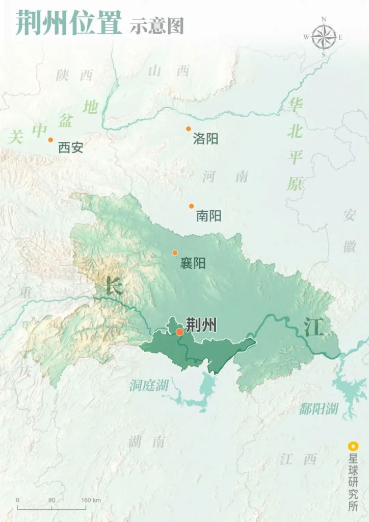
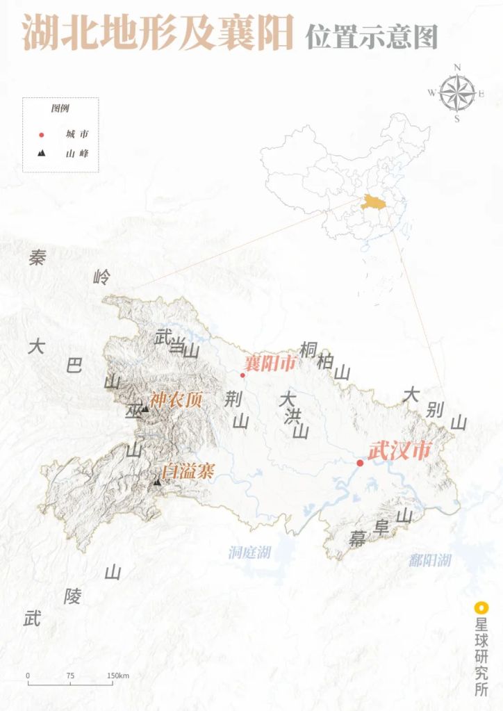
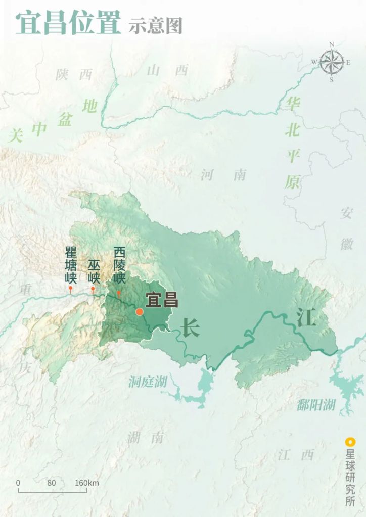
Hubei is located at the centre of China.
Horizontally, it sits on the border between the second and third step of the country’s three-step ladder terrain.
The Yangtze River courses down from the second step of the ladder through the province, connecting the Sichuan Basin in the west and the plains along the midstream and downstream of the river in the east.
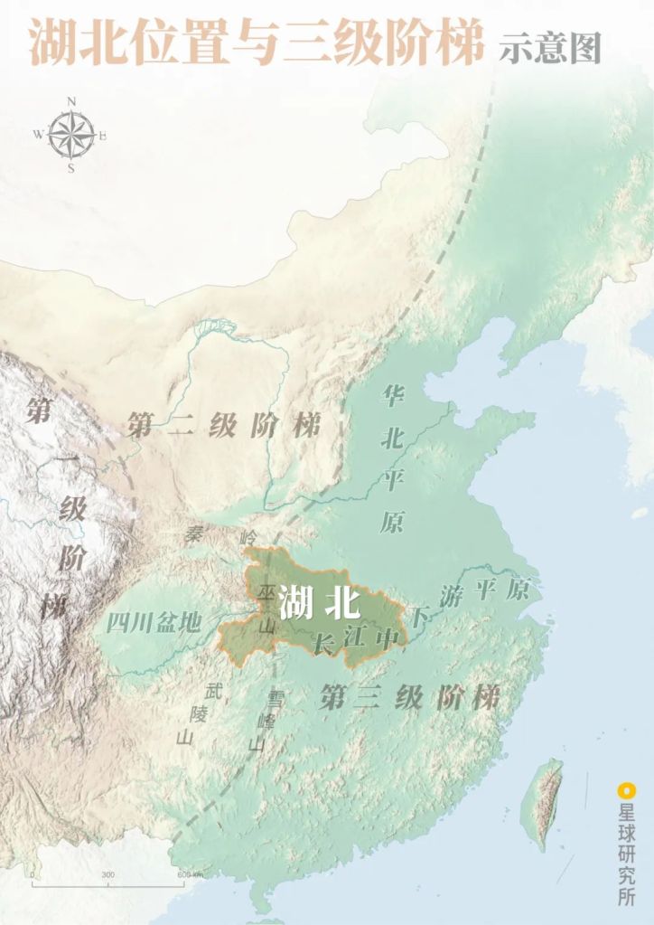
First (第一级阶梯), second (第二级阶梯) and third step of terrain ladder (第三级阶梯)
(diagram: 赵榜 & 陈思琦, Institute for Planets)
Vertically, the Qinling-Huaihe Line which separates the north and south runs along the northern border of Hubei.
Sitting on this division line, Hubei is immediately facing the North China Plain and Guanzhong Basin in the north, while connected to the Lingnan Region in the far south via the Dongting Lake Plains in Hunan.
Bridging the west and east while linking the south and north, Hubei is basically the crossroad of China.
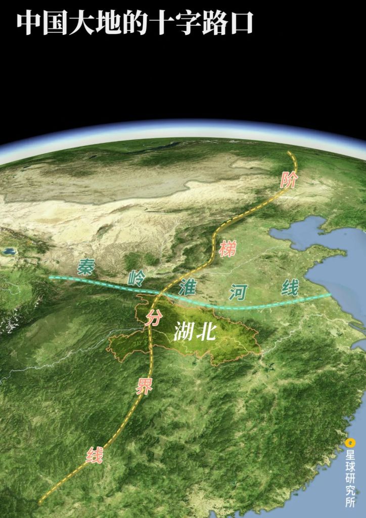
Hubei (湖北), Border of terrain ladder (阶梯分界线), Qinling-Haihe Line (秦岭淮河线)
(diagram: 赵榜 & 陈思琦, Institute for Planets)
Within Hubei, this crossroad was designated at two distinct locations during different historical periods, which resulted in the heroic rise of the twin cities.
Prior to Tang Dynasty, the political centre of China was mainly situated in the Guanzhong Basin and around Luoyang. Back then, a major corridor originating from Luoyang extended south through Nanyang and Xiangyang, and intersected with the Yangtze River within Hubei, thereby establishing the first crossroad in the province.
That intersection was Jingzhou.
Luoyang (洛阳), Nanyang (南阳), Xiangyang (襄阳), Jingzhou (荆州), Yangtze River (长江)
(diagram: 赵榜 & 陈思琦, Institute for Planets)
Jingzhou was the first hub city to be established in Hubei.
It served as the capital of the State of Chu for over 400 years throughout the Spring and Autumn and Warring States Periods.
(photo: 邓双)
It was also a strategically important location during the Three Kingdoms Period, the control over which all the states of Wei, Shu and Wu fought fiercely for. In the end, it was Guan Yu, a general of Shu, who ‘inadvertently lost Jingzhou (大意失荆州)‘ to Wu.
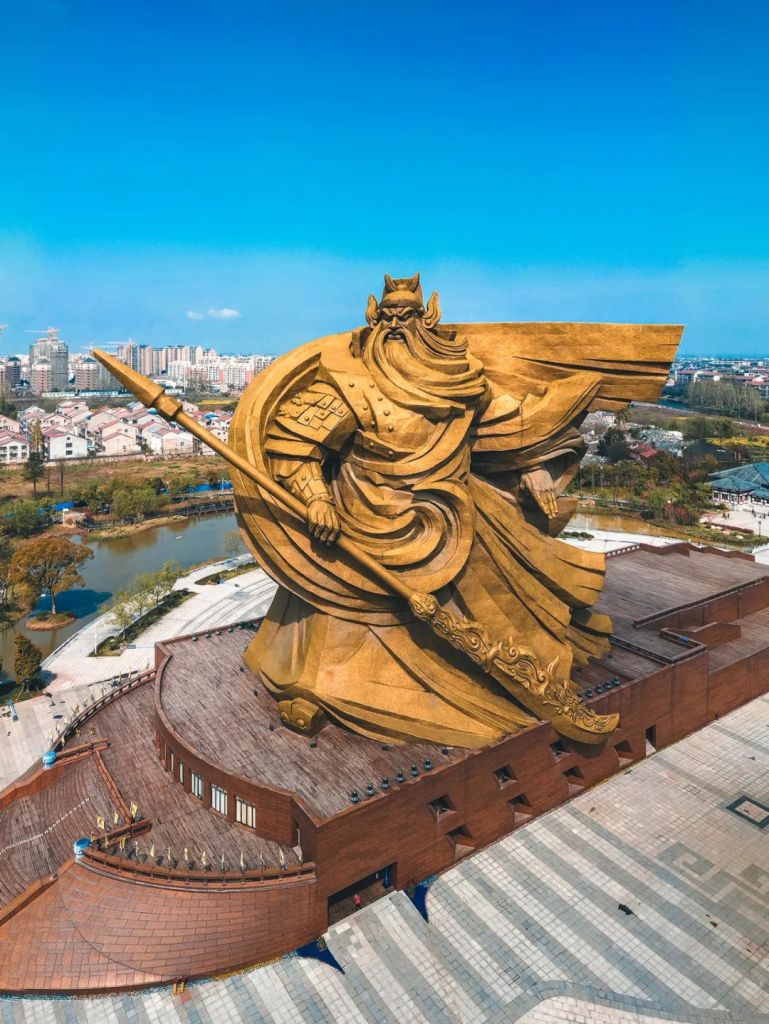
The statue is 58 metres high and the blade is 70 metres long
The Jingzhou during the Three Kingdoms Period had a larger territory; the Jingzhou government was based in Jiangling, equivalent to the Jingzhou District today
(photo: 邓双)
Li Bai, a renowned poet during the Tang Dynasty, spent just one day on the waterway on the Yangtze River to complete his 350 kilometres ‘light speed’ journey from Baidicheng in Chongqing to Jingzhou.
朝辞白帝彩云间
千里江陵一日还In the midst of clouds all glowing, Baidi, I left you at dawn.
《早发白帝城》李白 (701-762 AD)
By evening I’ll be home at Jiangling*, a thousand miles I’ve gone.
English translation by Frank C Yue
*equivalent to Jingzhou District today
Existing buildings in the ancient town were mostly renovated during the Ming and Qing Dynasties
(photo: 邓双)
From the Song Dynasty onwards, China’s political centre was relocated to the east.
Whereas the capital city moved over time from Kaifeng to Hangzhou, Beijing and eventually Nanjing, the economic powerhouse migrated south to the Jiangsu and Zhejiang regions in the downstream of Yangtze River.
Wuhan, which was more east-leaning, gradually showed its edge as a hub for transport and communication. And this could not have been possible without the two close companions, Ezhou and Huangshi.
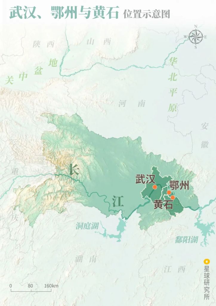
(diagram: 赵榜 & 陈思琦, Institute for Planets
Ezhou and Huangshi were very rich in mineral resources.
The very reason why the rulers of Shang Dynasty decided to build a city in Wuhan 3500 years ago was to control the copper resources in these two cities.
In the following 1000 years or so, the ancient Tonglüshan Mine in Huangshi produced about 100 thousand tons of raw copper in total, making it the ‘national treasure’ that forged the Chinese Bronze Age.
(photo: 侯刚峰)
And in late Qing Dynasty, iron ores produced here were continuously sent to the Hanyang Iron and Steel Works in Wuhan to kick start the steel industry in China.
The mine produced as much as 140 million tons of iron ore in total. All that mining reduced a mountain into a 400 metres deep ‘sinkhole’.
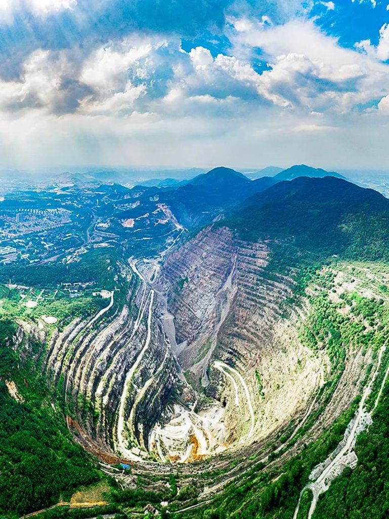
The smelted steel was most needed for the construction of the Beijing-Hankou (Jinghan) and Guangzhou-Hankou (Yuehan) Railways, which operated on opposite banks of the Yangtze River in Wuhan.
With railways stretching north and south, and a large river flowing from west to east, Wuhan is widely known as the ‘Nine Provinces’ Thoroughfare‘.
This makes Wuhan the second crossroad of Hubei.

The intersection of Yangtze River and Han River in Wuhan is another reason for the city’s rise, allowing to better manage the province
Jinghan Railway (京汉铁路), Yuehan Railway (粤汉铁路), Yangtze River(长江)
(diagram: 赵榜 & 陈思琦, Institute for Planets)
Where thousands of ships race on the coursing river today.
And countless arrows are poised to strike day and night.
But for Hubei, being a national crossroad or thoroughfare is just one side of the coin. Its strategic and tactical importance makes the province extremely susceptible to the ravages of military actions.
And here comes the first hammering on Hubei.
Wars.
What could defend it?
2. Natural defensive barriers 四方屏障
The key to defence is the natural barriers that surround Hubei.
Topographically, Hubei lies horizontally on the border of China’s ladder terrain, stepping down from the second step of the ladder in the west onto the third step in the east.
The western mountain ranges are especially tall and inaccessible.

Wuhan (武汉), Xiangyang (襄阳)
Wuling Mountains (武陵山), Wu Mountains (巫山), Wudang Mountains (武当山), Tongbai Mountains (桐柏山), Dabie Mountains (大别山), Mufu Mountains (幕阜山)
(diagram: 赵榜 & 陈思琦, Institute of Planets)
The Qinling Mountains and Daba Mountains extend all the way from Sichuan and Shaanxi and guard the northwest.

It is in the eastern range of the Daba mountains
(photo: 徐欣)
Defending the southwest are the 2000 metres tall Wuling Mountains that originate from the highlands of Yunnan and Guizhou.
(photo: 傅鼎)
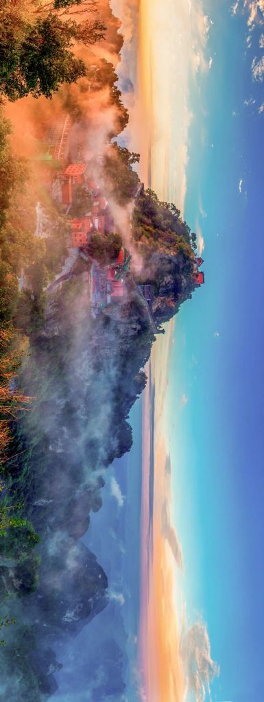
Standing strong in between are the Wu Mountains with a maximum elevation of 1822 metres. The Yangtze River that cuts through the ranges creates the precipitous and serpentine Wu Gorge, the second of the Three Gorges.
The 1822-metre elevation is the highest for Wu Mountains within Hubei
(photo: 李心宽)
And the champion of elevation in Henan, Hubei and Hunan goes to Shennongjia, which is famed the ridge of Central China with an elevation of 3106 metres.
(photo: 程境)
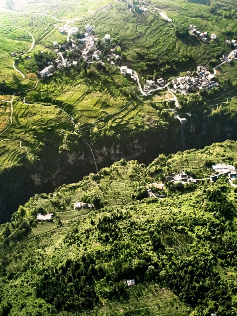
In addition, the abundant rainfall in the western regions of Hubei continuously dissolves the carbonate rocks widely distributed in the area. Over time, it carves out spectacular karst landscapes, including the Tenglong Cave, whose entrance is 72 metres tall and 64 metres wide.
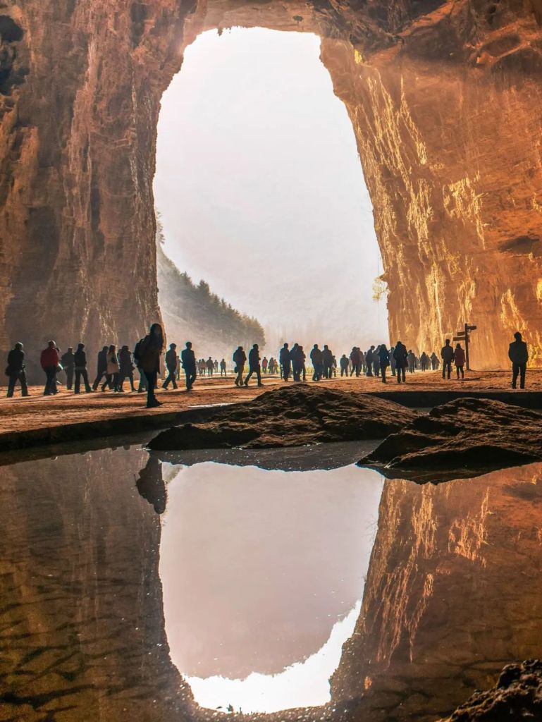
As well as the 108 kilometres long Enshi Grand Canyon.
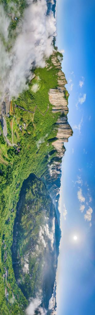
Note the waterfall and tourist elevators to get a feel of the enormity of the canyon
(photo: 李云飞)
When viewed from above, the vast ground seam looks like a massive gap between the split up lands.
(photo: 在远方的阿伦)
Three administrative units, namely Enshi, Shennongjia and Shiyan, line up along the chain of mountain ridges to form the western barrier.
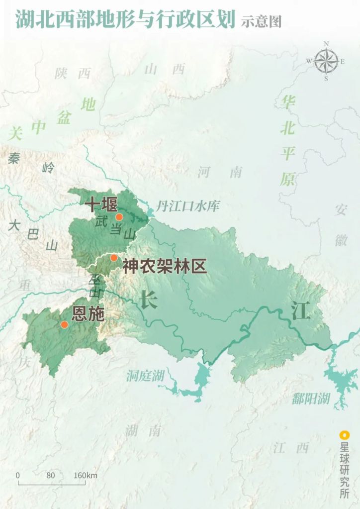
Enshi (恩施), Shennongjia Forestry District (神农架林区), Shiyan (十堰)
(diagram: 赵榜 & 陈思琦, Institute for Planets)
The mountainous terrain in Enshi provides a natural shelter for minorities and their cultural development. About 54% of Enshi’s population is made up of 28 minority groups including the Tujia, Miao and Kam people.
It was the residential area for Tusi (tribal chief recognised as imperial officials) during Yuan, Ming and Qing Dynasties
Photo shows contemporary buildings
(photo: 文林)
Shiyan, on the other hand, was chosen in the 1960s to be part of the Third Front Movement initiated for national defence and infrastructure purposes. The remote city sitting deep in the mountains impressively turned into a modern automobile city.
The Second Automobile Works was later renamed Dongfeng Motor Corporation
(photo: 程境)
Best known as the ‘untouched wilderness’, 90% of Shennongjia‘s territory is covered by forests. With more than 3900 plant species and 1000 animal species, it is the best preserved northern subtropical ecosystem at the mid-latitude of northern hemisphere.
(photo: 姜轲)
A natural barrier gating only the west border is certainly far from sufficient.
Hubei is also surrounded by mountains in the north and east. Almost like a basin, it is protected by Xiangyang, Suizhou, Huanggang, Xianning and Yichang lining the basin rim. Together, these five cities form a half-ring barrier.
Qutang Gorge (瞿塘峡), Wu Gorge (巫峡), Xiling Gorge (西陵峡), Jing Mountain (荆山), Dahong Mountain (大洪山), Tongbai Mountain (桐柏山), Dabie Mountain (大别山), Mufu Mountain (幕阜山)
(diagram: 赵榜 & 陈思琦, Institute for Planets)
In the north, Suizhou is sandwiched by the Dahong Mountains and Tongbai Mountains in the south and north, respectively, forming a two-fold natural barrier.
(photo: 田春雨)
The geographical importance of Suizhou was already noticed by the rulers of Zhou thousands of years ago, which prompted the establishment of the state of Zeng. It was primarily assigned to surveil any instabilities across the Jianghan Plains.
The tomb of Marquis Yi of Zeng that shocked the world was excavated right here in Suizhou.
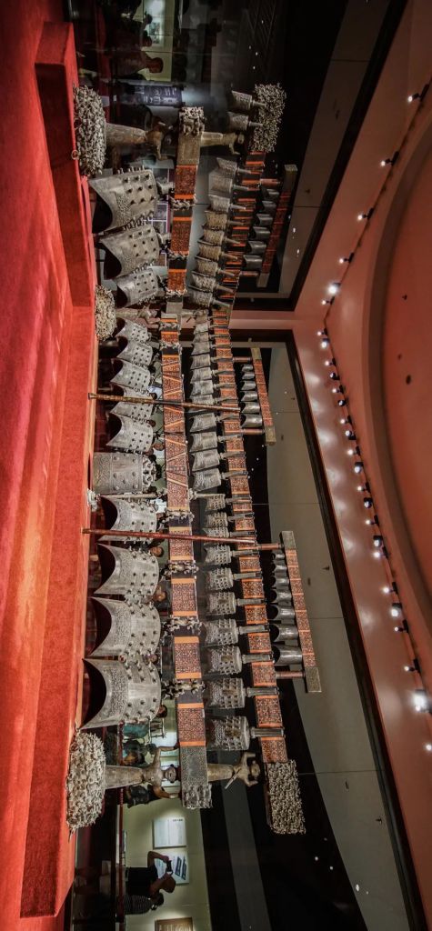
The state of Zeng was once mistaken as Sui by many scholars
(photo: 沈噌噌)
In the northeast, the Dabie Mountains spread across Huanggang like a wall with a maximum height of 1700 metres.
This city of mountains and forests have cultivated generations of revolutionists, including the 440,000 lives dedicated to the establishment of New China. Among those, 53,000 are officially recognised as martyrs and more than 200 of them are regarded as founding generals of the country.

It is one of the major peaks of Dabie Mountains
(photo: 朱金华)
And in recent years, Huanggang became a national legend in education. Its success is largely built up through their energetic and determined attitude — ‘tough learning among students, tough lessons from teachers, tough accompaniment by parents (学生苦读,老师苦教,家长苦帮)‘.
Xianning in the southeast is joined by the towering Mufu Mountains with a maximum elevation of 1600 metres.

(photo: 应文)
The famous Battle of Chibi (literally ‘red cliff’) during the Three Kingdoms Period was fought in Xianning.
And during the Northern Expedition in the last century, the expeditionary army managed to launch the attack on Wuhan only after successfully taking Xianning following the Tingsi Bridge Battle and the Hesheng Bridge Battle.

(photo: VCG)
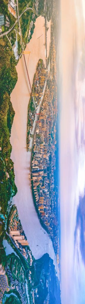
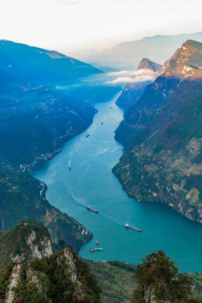
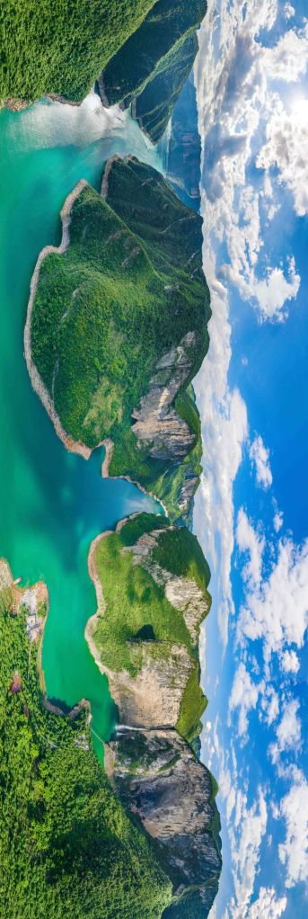
Yichang in the west is a transition zone between the western mountain ranges and the plains. Qing River, the 423-kilometre tributary of the Yangtze River, curls through the rolling hills in the city, creating the scenic Qing River Gallery.
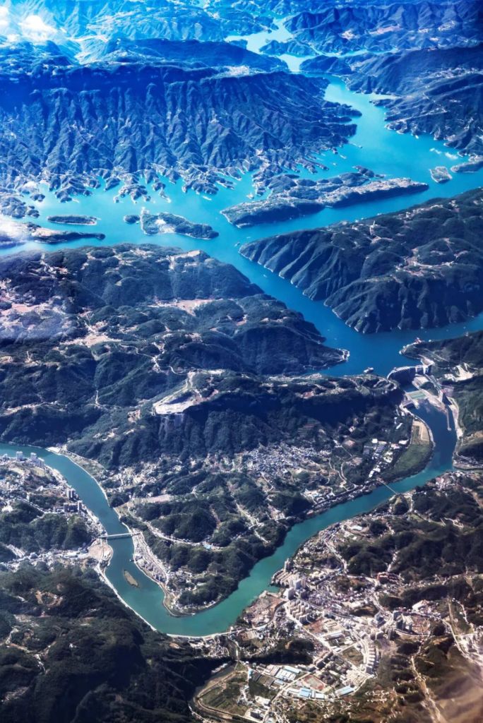
(photo: 傅鼎)
More spectacular is the Xiling Gorge, which is the longest among the Three Gorges with a total length of 76 kilometres.
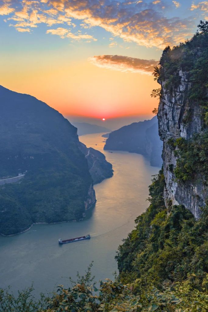
Because of the Xiling Gorge, Yichang is able to ‘monitor Bashu regions in the upstream, and control Jingxiang regions in the downstream (上控巴蜀,下引荆襄)’.
This highlights the strategic significance of Yichang.
The island in the centre of the river is Xiba
(photo: 李理)
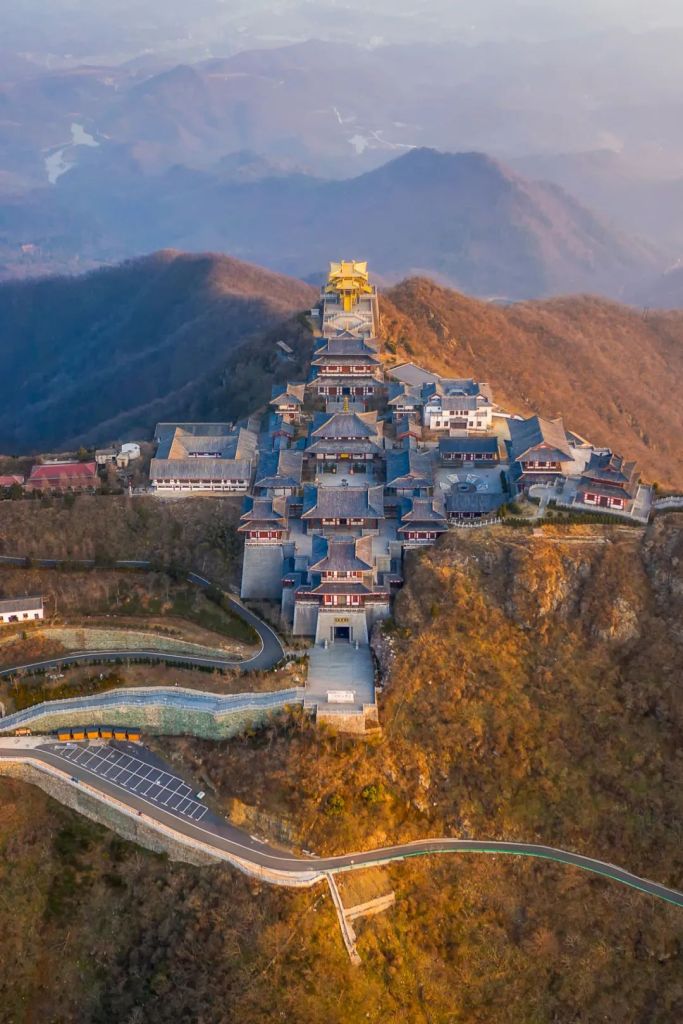
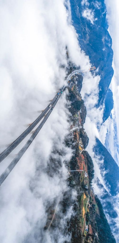
The most critical position of all in the half-ring barrier is Xiangyang in the northwest, which is quite a substantial breach in Hubei’s mountainous defence formation.
(diagram: 赵榜 & 陈思琦, Institute for Planets)
Wars were frequent in the Central and North China Plains in ancient periods. They often spread to the south together with refugees fleeing from them.
This makes Xiangyang, a breach point of the defence barrier, the most important military stronghold in Hubei.
Its border in the north leaned against the Han River, and the remaining border was protected by the widest moat ever built in Chinese history. The moat we see today is on average 250 metres wide, and almost 280 metres at the widest.
This is where the phrase ‘Xiangyang the fortress town‘ comes from.
(photo: VCG)
It was in Longzhong, Xiangyang, where Zhuge Liang, the renowned strategist during the Three Kingdoms Period, proposed the Longzhong Plan.
The Battle of Fancheng, which happened in today’s Xiangyang, was famously adapted in Romance of Three Kingdoms as the Drowning of Seven Armies incidence organised by Guan Yu.
Part of the Legend of the Condor Heroes by Jin Yong was set during the decisive Battle of Xiangyang between the Mongols and Song Chinese, which lasted 6 years and sealed the fate of the falling Song Dynasty.
In addition, there was the Battle of Xiangfan between the Song and Jin.
The attack on Xiangyang during the peasant uprising in the late Yuan Dynasty.
And the Battle of Xiangyang through which Zhang Xianzhong captured the city towards the end of Ming Dynasty.
As well as the Battle of West Henan-North Hubei during the Second Sino-Japanese War.
There were no fewer than 170 battles fought in or for Xiangyang.
The exact location of Longzhong is still controversial
(photo: 颜京利)
Throughout the centuries, Hubei has passed numerous tests of warfare, thanks to the western and half-ring barriers.
With the dawn of peace today, can Hubei, the crossroad of China, finally explore its full potential?
Not so fast.
What closely follows is the second hammering.
Floods.
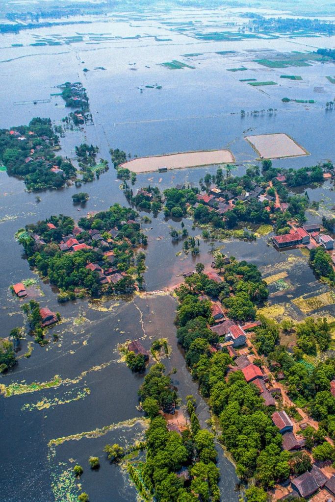
3. The heartland of Jianghan Plain 江汉腹地
Looking back on history, Hubei never really had an impressive economic status in the country ever since the Qin Dynasty. It always fell behind Jiangxi, Jiangsu and Zhejiang, which are also in the midstream and downstream of the Yangtze River.
An important reason for this, apart from the recurrent cycles of war and rebuilding, is the excessive abundance of water.
All the mountainous around Hubei contribute to the large number of rivers flowing through the province, including more than 1000 small rivers (<5 kilometres), 4000 medium rivers (>5 kilometres) and 41 large rivers (>100 kilometres).

(photo: 春凋在路上)
On the right is the Butterfly Cliff Waterfall
(photo: 李云飞)
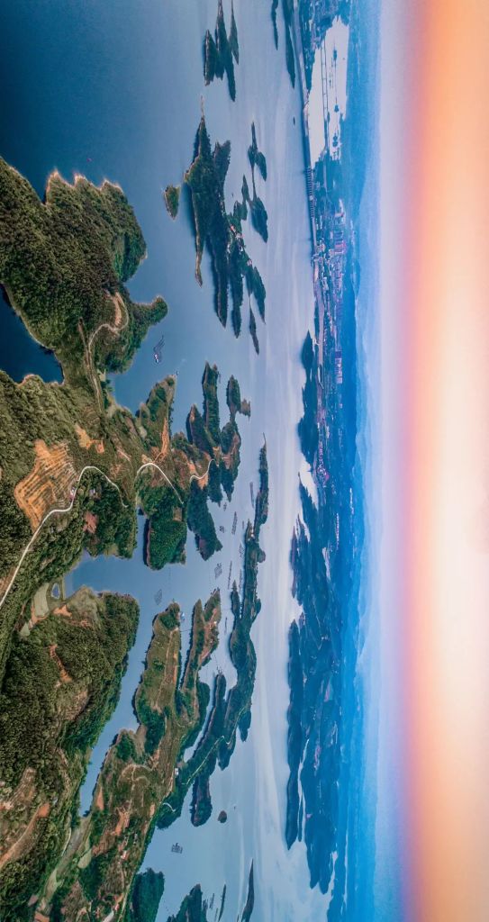
Owing to the basin structure of Hubei, these rivers all converge and enter the Yangtze River and its branches. With 99% of the province’s territory belonging to one river basin, Hubei is where ‘all waters become one (众水归一)‘.
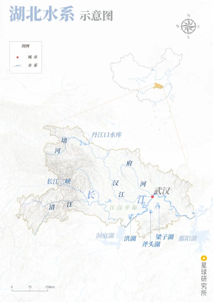
Jianghan Plain (江汉平原), Wuhan (武汉)
Yangtze River (长江), Zhu River (堵河), Qing River (清江), Han River (汉江), Fu River (府河), Three Gorges of Yangtze River (长江三峡)
Danjiangkou Reservoir (丹江口水库), Dongting Lake (洞庭湖), Hong Lake (洪湖), Futou Lake (斧头湖), Liangzi Lake (梁子湖), Poyang Lake (鄱阳湖)
(diagram: 赵榜 & 陈思琦, Institute for Planets)
For tens of thousands of years, this ‘all become one’ river system had fertilised the basin which is known today as the Jianghan Plain.
(photo: 陈小羊)
The elevation of much of the Jianghan Plain is below 35 metres. This allows the Yangtze River to progress freely through the flat land like a meandering serpent.
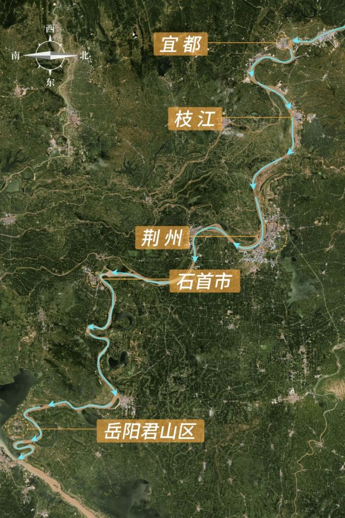
Yidu (宜都), Zhi RIver (枝江), Jingzhou (荆州), Shishou (石首市), Junshan District of Yueyang (岳阳君山区)
(photo: Esri Image Map)
The Yangtze River and other smaller rivers join force with rainfall in low-lying regions to create numerous lakes and wetlands, including the Chang Lake, Futou Lake and Liangzi Lake.
Hubei is therefore also known as the ‘thousand lake province‘.
The largest lake in Hubei today is the Hong Lake. With an area of about 348 square kilometres, it is one of the seven major freshwater lakes in China. The total lake area on the Jianghan Plain between 5500-500 BC was estimated to be about 12,250 square kilometres.
(photo: VCG)
But a plain predominantly occupied by lakes, marshes and slow-flowing rivers was not the best habitat for humans. Our ancestors therefore built dams, consolidated river banks and constructed dikes to make polders to farm around these lakes and marshes.
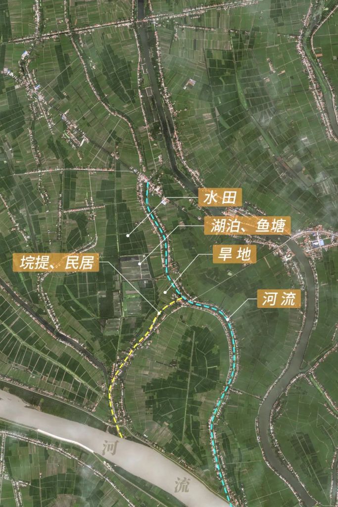
Paddy fields (水田), lake and fish pond (湖泊, 鱼塘), dry land (旱地)
Blue dotted line: river (河流); yellow dotted line: dikes and residential areas (垸提, 民居)
(photo: Esri Image Map)
Development in Hubei was ramped up to its peak during the middle and late Ming Dynasty and became the most important national granary. As the ancient Chinese saying goes, ‘a bumper harvest in Hubei and Hunan feeds all under heaven (湖广熟,天下足)‘.
But this comes with a heavy price.
Many lakes in Hubei disappeared, and the Jingjiang section of Yangtze River restricted by dikes rose up continuously. It slowly became a hanging river.
This is the border between Hubei and Hunan
(photo: 蓑笠张)
The plain with few and few lakes gradually lost its storage capacity for rivers. This led to frequent floods.
The Great Dike of Jingjiang, for instance, failed as many as 36 times over 390 years between 1559 and 1949. That was one failure every 11 years on average.
Hubei soon lost the title of national granary.
During the Late Qing Dynasty and the Republic era, food production dropped so significantly that Hubei struggled to even be self-sufficient, and had to rely on provisions from Hunan.
The idiom then became ‘a bumper harvest in Hunan feeds all in Hubei (湖南熟,湖北足)’.
(photo: 黄正平)
Even with the establishment of New China, floods continued to haunt the heartland of Jianghan Plain.
When the 1998 Flood hit, millions of soldiers were sent to defend the Great Dike of Jingjiang. Although they succeeded in preventing the dam from bursting, there were still up to 1770 incidents reported in various locations.
Flood problems have to be solved if Hubei ever wants to achieve any long-term development. In addition to returning farmlands back to the lakes to restore their natural storage capacity, a mega project was included in the latest agenda on flood control.
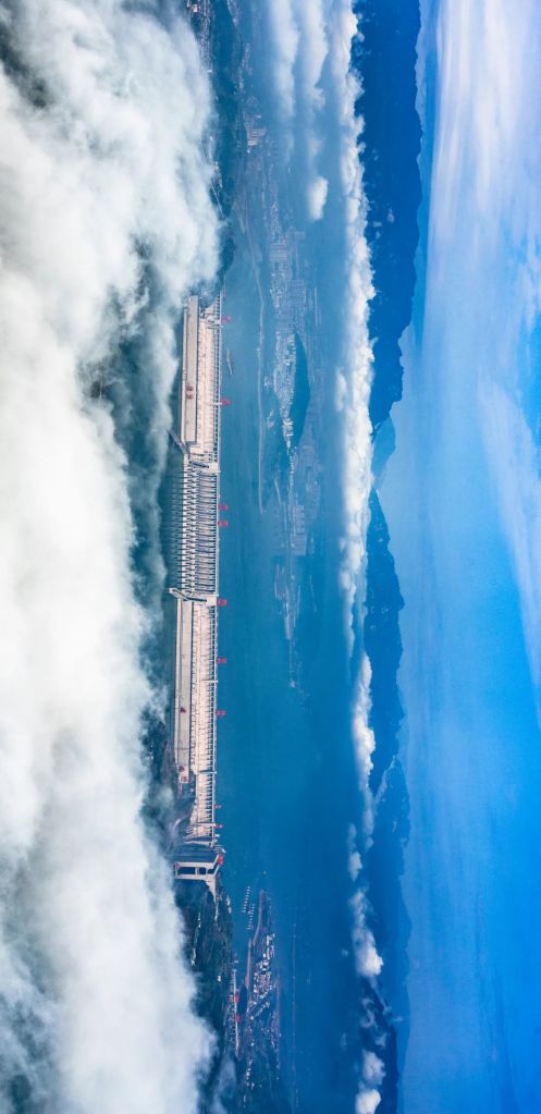
This time, Yichang took up the challenge.
Qutang Gorge (瞿塘峡), Wu Gorge (巫峡), Xiling Gorge (西陵峡) along the Yangtze River (长江)
(diagram: 赵榜 & 陈思琦, Institute for Planets)
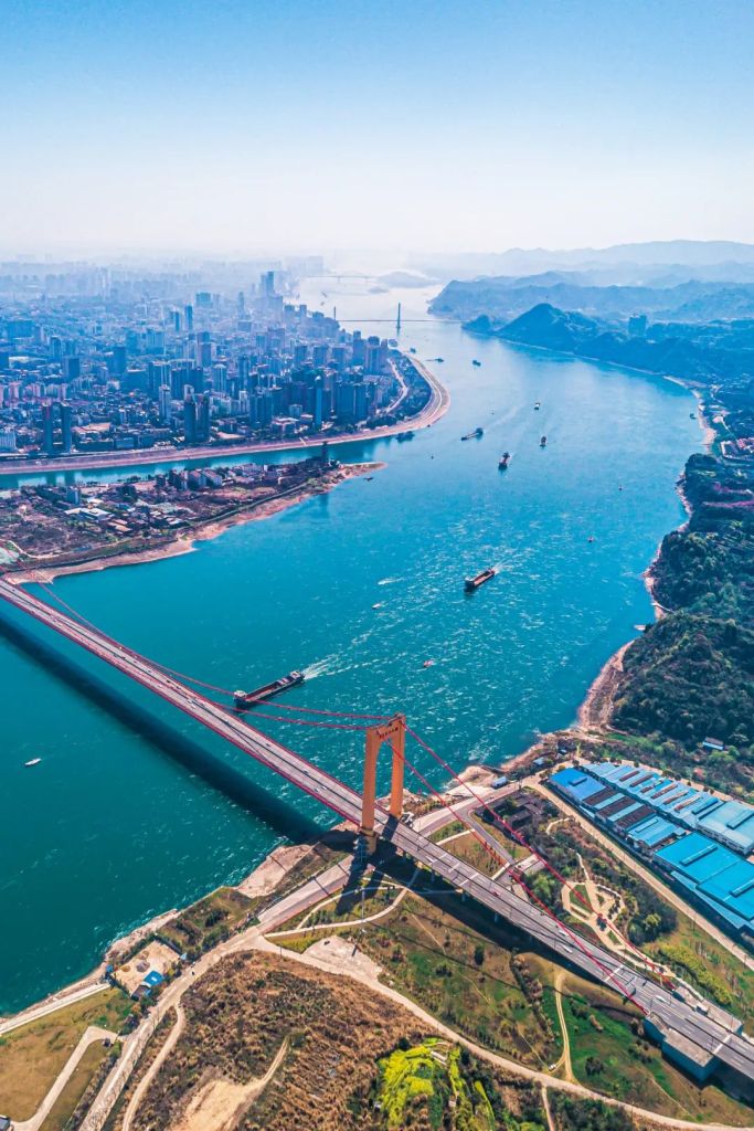
After submerging hundreds of towns and relocating millions of citizens, the Three Gorges Dam was completed in 2006 in Yichang.
With a volume of almost 40 billion cubic metres, this gigantic reservoir is capable of blocking flood peaks as well as generating electric power. Floods that bothered Hubei for thousands of years have since been largely mitigated.
The Jianghan Plain and the adjoining hilly lands can finally enjoy a safe environment for full-scale development.
Cities residing in these regions include not only Jingzhou and Wuhan, but also Jingmen, Xiaogan, Xiantao, Tianmen and Qianjiang.
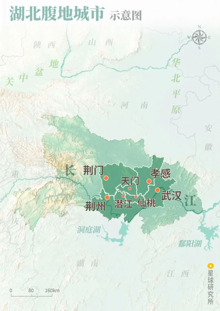
Jingzhou (荆州), Wuhan (武汉), Jingmen (荆门), Xiaogan (孝感), Xiantao (仙桃), Tianmen (天门), Qianjiang(潜江)
(diagram: 赵榜 & 陈思琦, Institute for Planets)
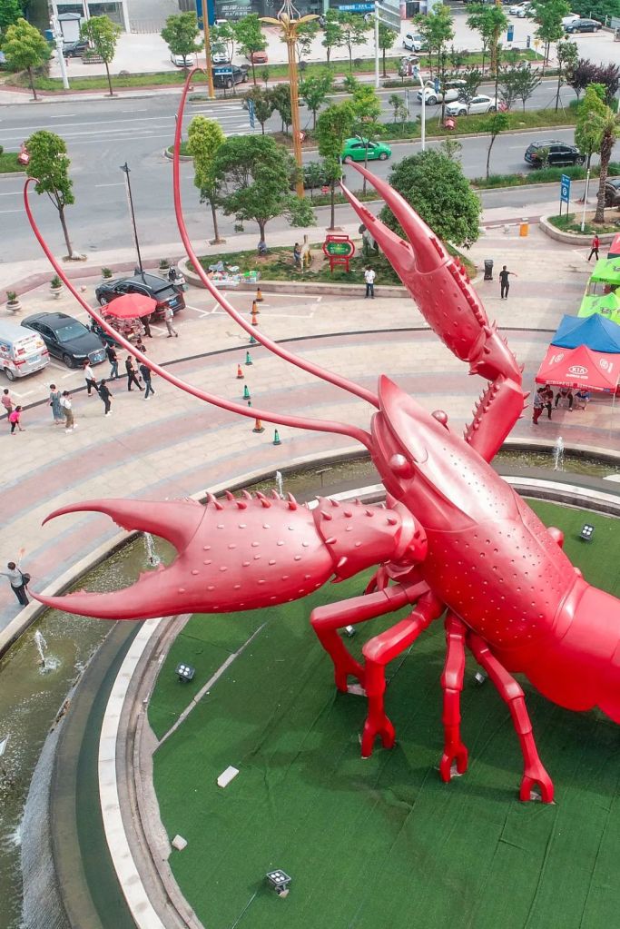
In Qianjiang, farmers innovated a rice-crawfish rotation system by farming crawfish in paddy fields. With the extra help of pond cultivation, the city can produce more than 90,000 tons of crawfish every year. Together with other regions in Hubei, they account for almost half the crawfish production in China.
(photo: VCG)
Xiantao is the largest manufacturing and processing centre for non-woven fabric in China. The masks and personal protection equipments mass produced here were constantly sent to the global frontline in the war against the pandemic.
As the ‘cotton’s home in China’, Tianmen once had a cotton plantation area of 800,000 mu. Today, it has the most complete cotton industry chain that consists of cotton plantation, trading, cotton spinning technology and spinning machinery manufacturing.
This Tang-style tower was built to commemorate Lu Yu, the Sage of Tea, who was originally from Tianmen
(photo: 张乔)
The largest imperial tomb of Ming Dynasty sits on 181.13 hectares of land in Jingmen. Known as the Ming Xian Ling Mausoleum, it is where the bodies of Jiajing Emperor’s parents rest.
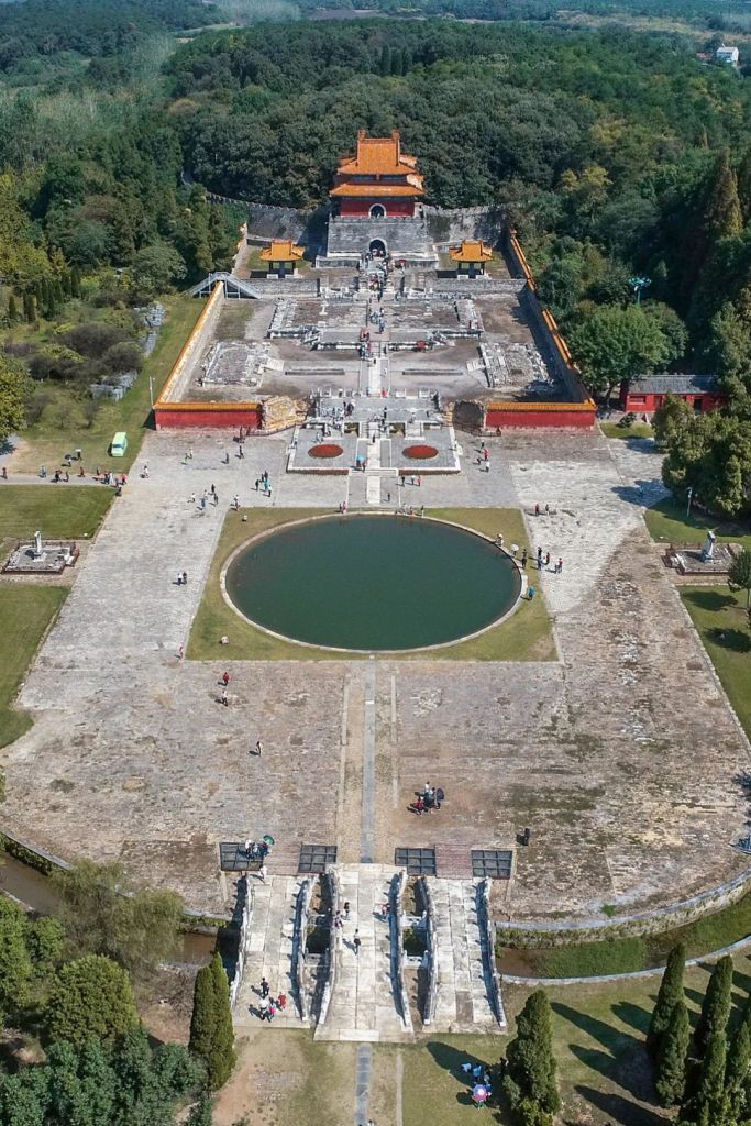
It is located in Zhongxiang, Jingmen
(photo: VCG)
Jingmen is quietly transforming itself with the help of two emerging industries, which are aviation manufacturing and electric vehicle manufacturing.
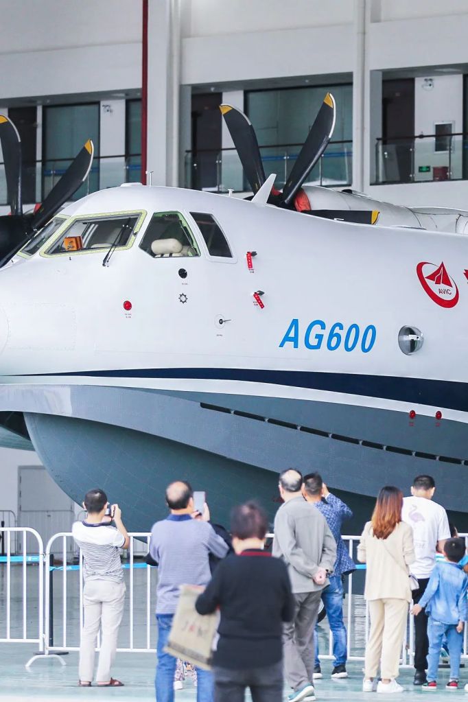
This is AVIC AG600, China’s largest amphibious aircraft
(photo: VCG)
Xiaogan brews the famous Xiaogan rice wine with glutinous rice of the best quality. And now, dozens of companies in Xiaogan are trying to establish an additional identity, the ‘China’s paper capital‘. The production capacity of tissue paper in the city today accounts for 16% of all production in the country.

(photo: VCG)
4. Back on track 重回正轨
And all these conclude what Hubei really is.
A land that survived centuries of remorseless wars and floods while nurturing the 17 administrative regions.
(diagram: 赵榜 & 陈思琦, Institute for Planets)
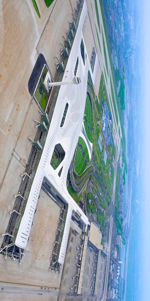
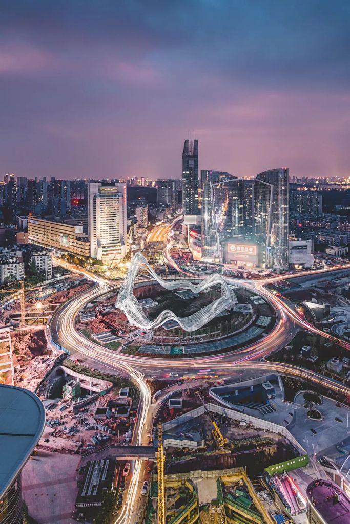
Today, with wars eliminated and floods mitigated, Hubei can finally unleash its full potential as the national crossroad.
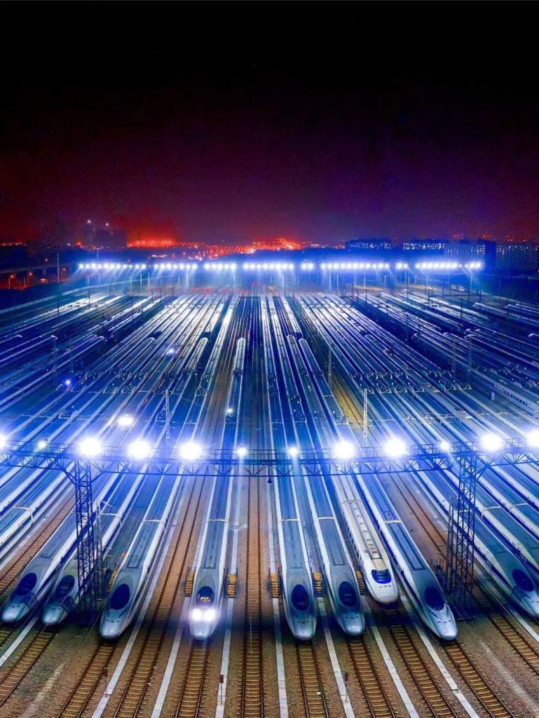
For China, it is an important passenger transportation hub.
(photo: 长江日报)
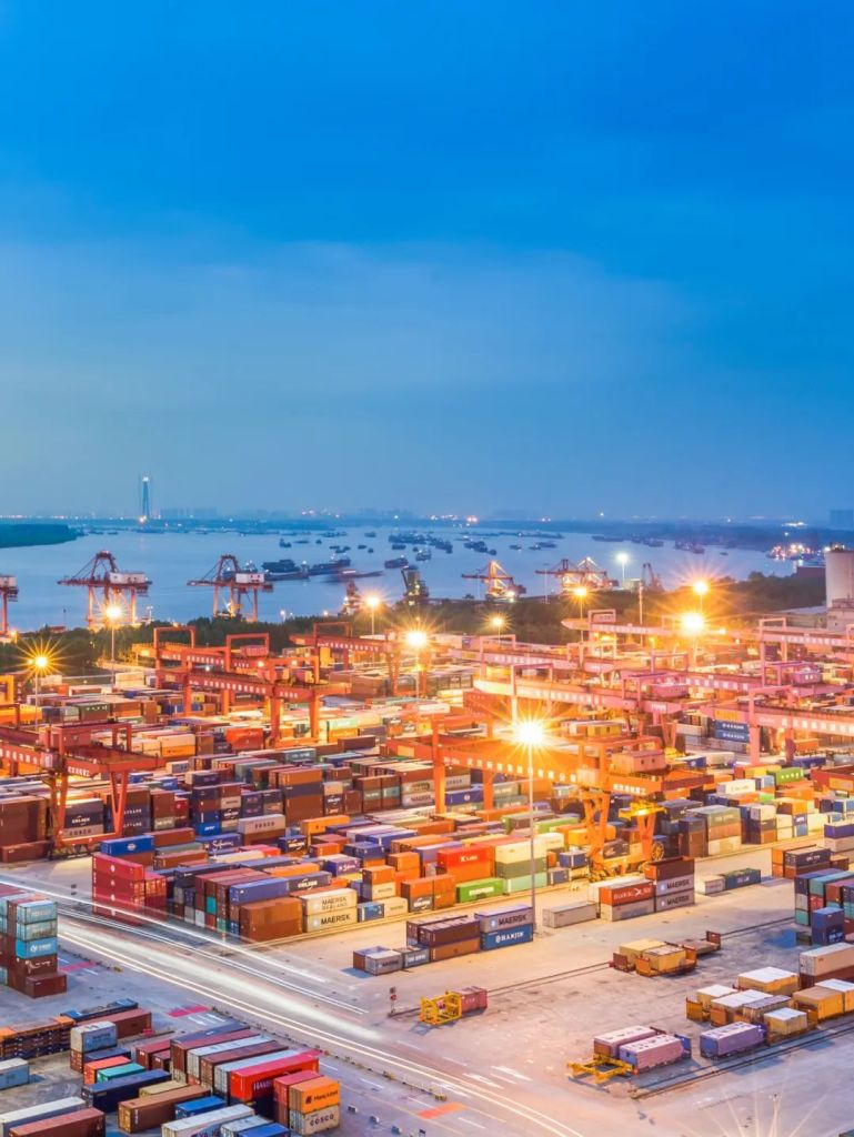
A crucial freight centre.
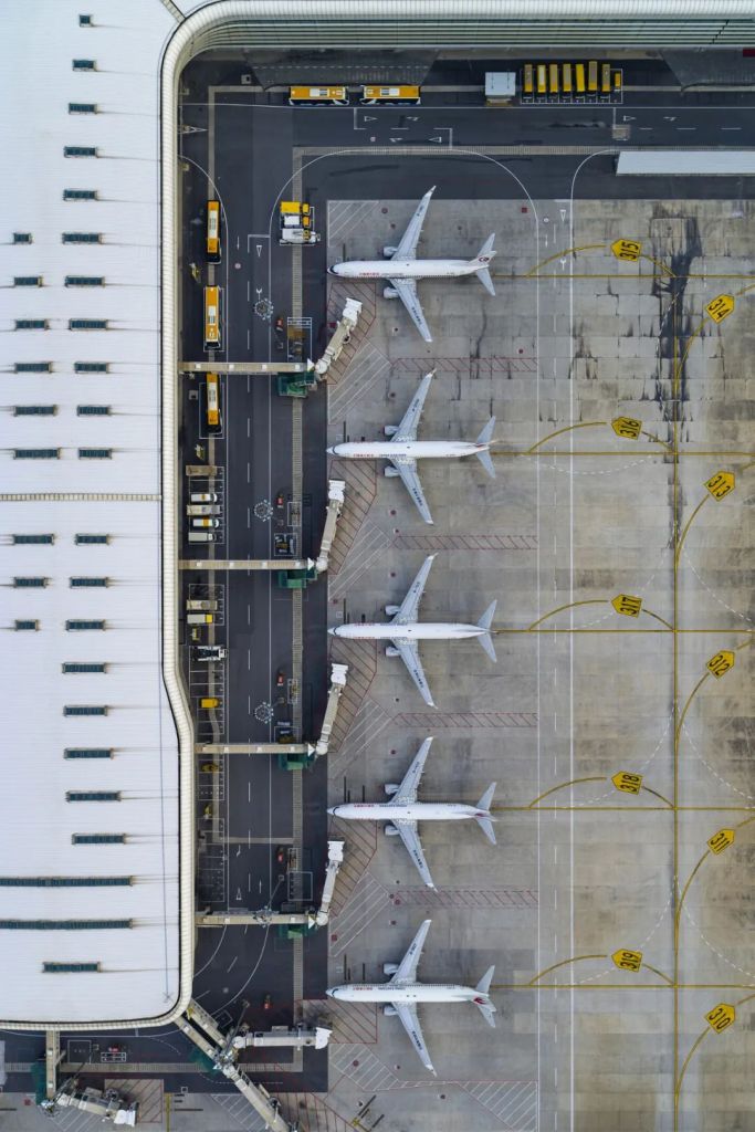
Busy epidemic prevention and control personnel delivering medical supplies during the pandemic
This precious photo was taken by a drone during a flight window period
(photo: VCG)
An irreplaceable ground for talent cultivation.
(photo: 田春雨)
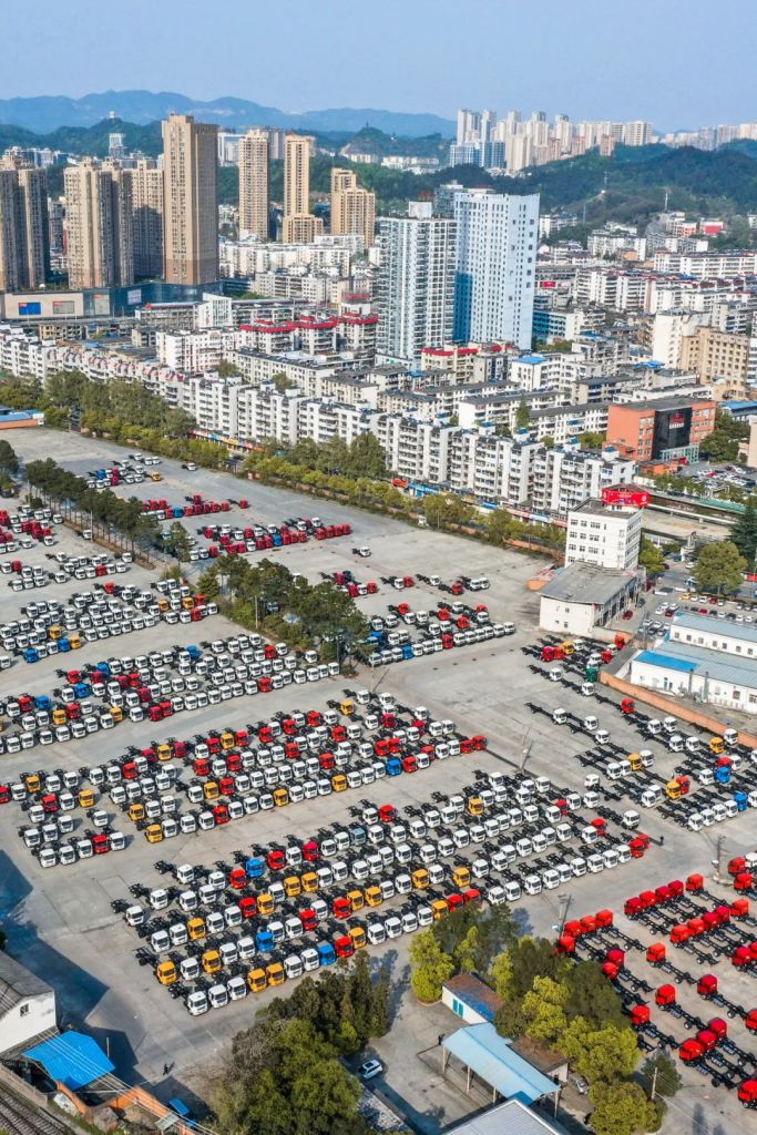
And a highly competent manufacturing base.

The production line had resumed business operation since 23 March 2020
(photo: VCG)
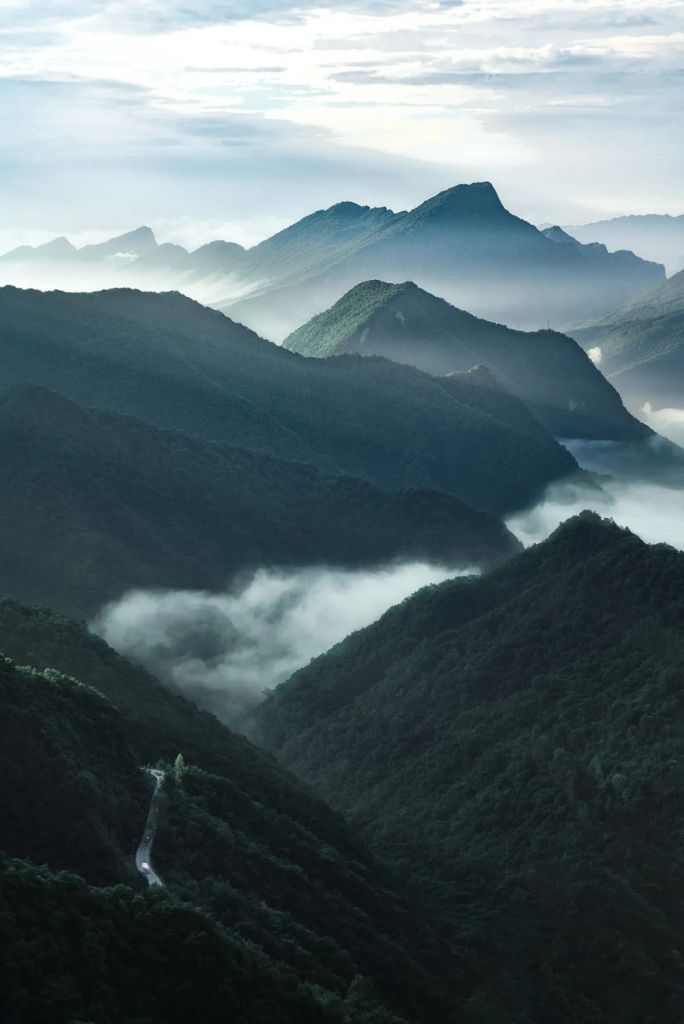
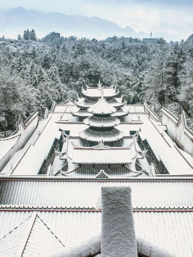
It is rich in cultural heritage of the thousand-year civilisation.
(photo: 颜京利)
And stimulate innovative minds that thrive at the frontier of cutting-edge technologies.
(photo: 欧昌宏)
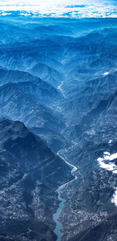
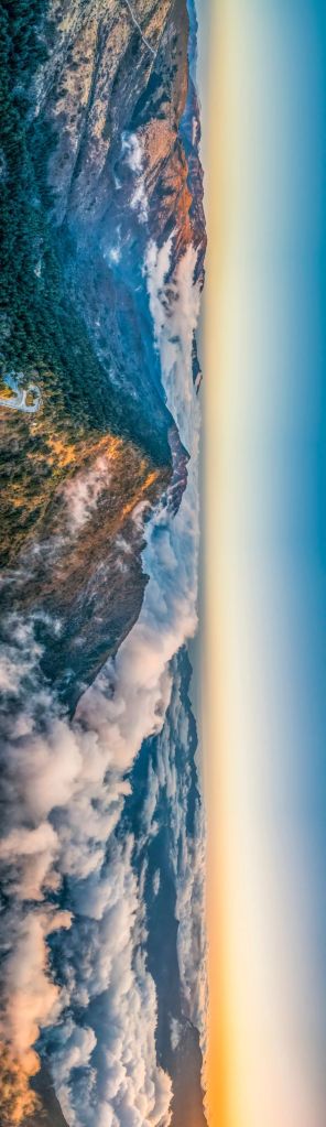
It is also blessed with the treasure of nature.
(photo: 颜京利)
After the meandering walk through the vicissitudes, Hubei, the land of affection, is slowly coming back on track.
(photo: 文林)
Production team
Text: 星球研究所 所长
Photos: 谢禹涵
Maps: 陈思琦
Design: 赵榜
Review: 王朝阳、撸书猫
Cover Photo: 李理
References
1. 李长安,《荆楚地理》,武汉出版社,2018
2. 章开沅等,《湖北通史》,华中师范大学出版社,2018
3. 宋传银,《湖北历史人口研究》,现代教育出版社,2009
4. 张伟然,《湖北历史文化地理研究》,湖北教育出版社,1999
5. 刘森淼,《荆楚古城风貌》,武汉出版社,2012
6. 李娟文等,《湖北地理》,北京师范大学出版社,2015
… The End …

星球研究所
一群国家地理控,专注于探索极致风光
